
Tornadic Chase Through N Central Nebraska (Chris Kridler & Dave Lewison)
| After driving most of the night from North Platte, NE, our Cloud 9 group
arrived in Hays, KS at about 3 am on Saturday. Chris Kridler was also staying there and I
was supposed to go back to the east coast with her later that day. Looking at the data
briefly when we finally woke up, our plans changed a bit...SPC issued a High Risk for the
S Central Nebraska area with a MDT Risk all the way down into Western KS. We couldn't
resist chasing this day! After a farewell lunch with the Cloud 9 group we parted ways and headed up 183 into NE to I-80. At the intersection, we stopped at a truck stop to get some data. About 15 minutes later, the Cloud 9 group arrived followed later by Rocky and a slew of other plains chasers (I'm terrible at remembering names). This truck stop had terrible phone lines for data transmission...I couldn't get more than 2400 bps on my laptop. So, we relied on TWC that was being shown on 3 TV's in the lounge. It looked like a warm front was setting up north of our location in an east-west orientation curving more SW to our west. Again, we parted ways, and continued north on 183 with the target of Taylor in mind. |
|
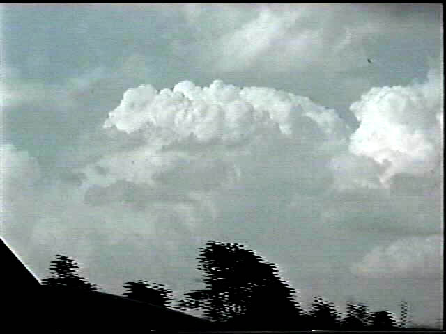 |
When we got to Taylor, we saw this tower sprouting up to our immediate
ENE. Catching this storm was tough seeing that the general storm motion that day was NNE
at almost 50! We did manage to get close to it as it shriveled up and died somewhere south
of rte. 20 near Atkinson. After giving up on this storm, we decided to go after a storm to our SW, because the anvil on it was looking pretty sharp. We ran into Tim Samaras on hwy 11 southbound. He was kind enough to share some information from his satellite dish. That storm to our SW was looking better and better. |
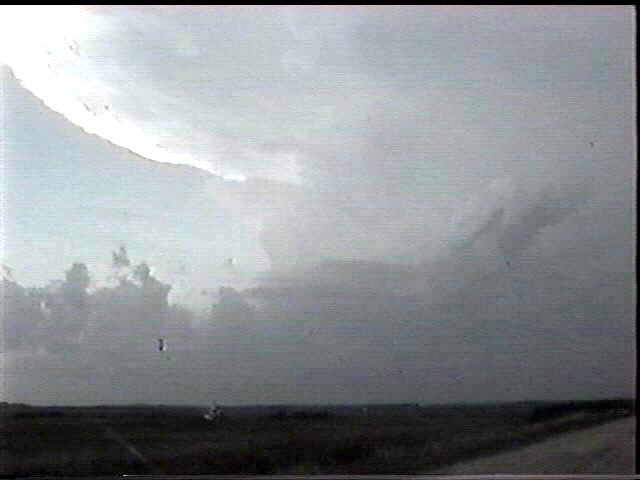  |
Arriving in Basset, we turned south on 183 to try to get closer to the updraft. These two pictures show the curving inflow bands and main updraft spreading out to a sharp, circular anvil. Noting the rapid northward movement, we decided to turn around and wait for it just west of Basset on rte. 20. Time was about 7:40 pm. |
 |
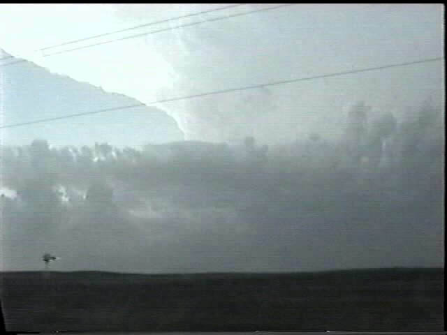
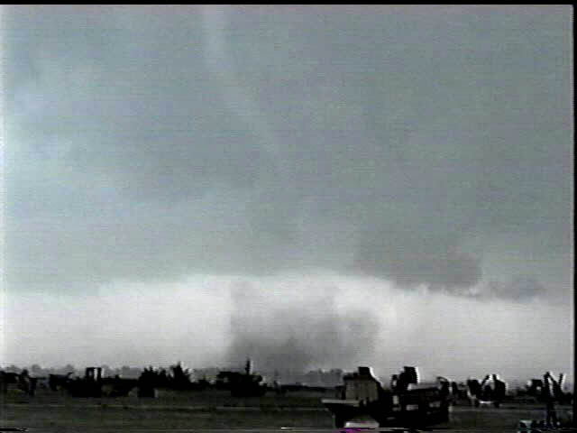
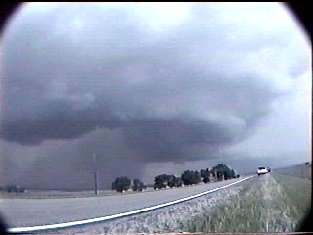
About a half hour later we were sitting facing west on ret. 20 about 2
miles west of Basset. The storm approached quickly and we were engulfed in pea to marble
sized hail. There were no real lowerings for a while. Suddenly, the motion began to pick up with a lot of scud moving in towards an updraft base. Within a few minutes this wall cloud had formed, complete with sharks teeth. (Upper left area of photo). |
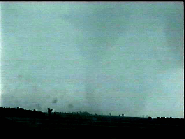   |
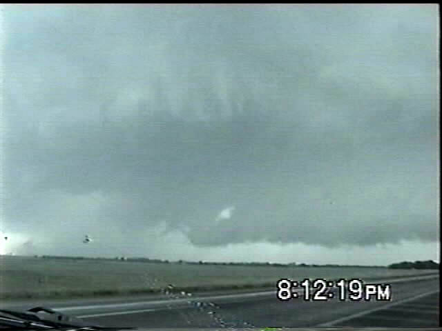
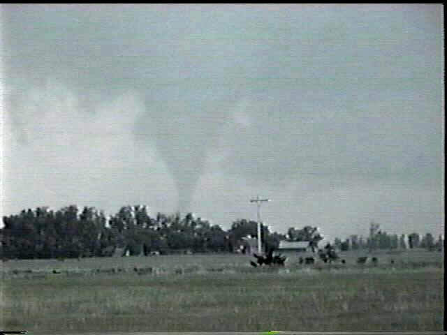
A few minutes later a funnel dipped down out of this wall cloud and made
contact with the ground a mile or two to our south. It was initially wrapped in heavy
precip, but it soon moved more out in the open with the debris cloud clearly visible. As
it was roping out, it snaked around magically making intermittant contact with the ground.
It did this for about 8 minutes as we were blasting east on 20 to stay ahead of it. At
times it was only about 1/4 to half a mile away! Meanwhile, the next meso was quickly
taking shape to our NE. View is from rte. 20 looking almost due south. |
  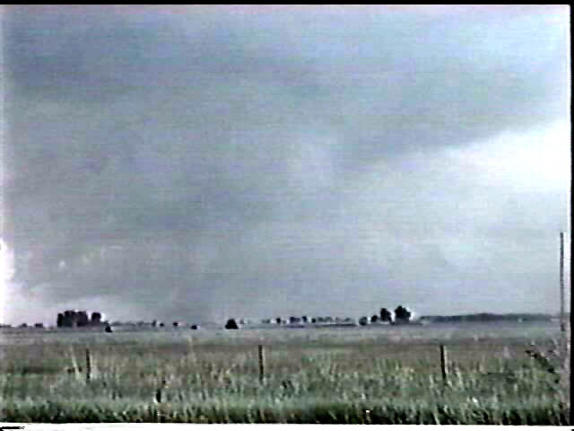 |
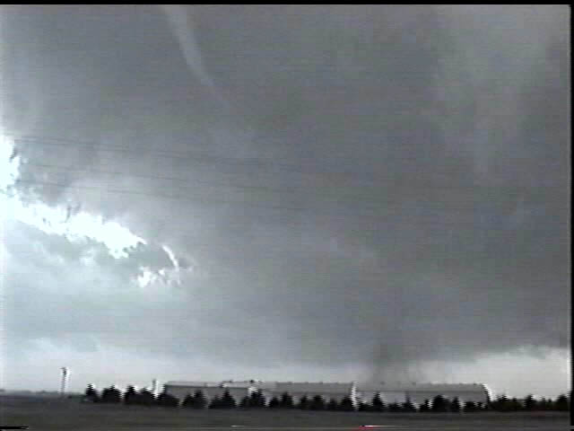
Within 15 minutes the next meso took over and produced a big cone tornado. From rte. 20 we could see it clearly a few miles to our north. It developed a large debris cloud which began to obscure it somewhat, making the cone difficult to see. |
 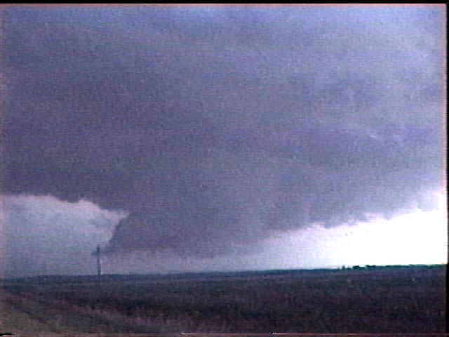 |
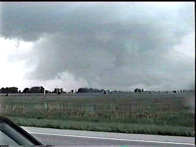
Finally, we were able to turn north on 137 to try to catch the third meso
shown in wide angle here. This meso was trying to produce a wall cloud and tornado, but it
was moving way too fast to avoid being undercut by cold outflow. It did not produce any
further tornadoes. We met up with the Cloud 9 group again on hwy 12 just south of the SD border and exchanged video clips and stories. From there, we began the 26-hour marathon drive back to Baltimore, MD. |
May 14 | May 16 | May 20 | May 25 | May 26 | May 31 | June 5