 |
|
- May 31st -
El Reno, OK
Video of our El Reno tornado chase
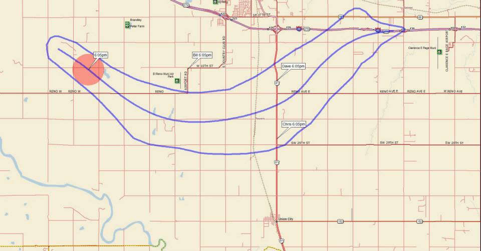
While waiting, our gas station attracted at least a dozen other chasers, and we got a chance to hang out with Anemometer Steve, Melanie Metz, Dan Robinson, Dan Shaw and many others, including Reed Timmer's Dominators I & II. Around 4:30pm, the first real storm towers went up in the extremely unstable air, and quickly became supercells. Initially, there were 3 cells...one south of I-40, one north, and one right on it. We went west and then north at Calumet, targeting the northern storm since it was the first to go up. We quickly realized that storm was getting interfered with by the other cells, so we abandoned it and cut east on a dirt road and then back south on Hwy 81 into El Reno again. From there, we went a few miles south of town and waited at the side of the road as the southern cell became dominant and started coming towards us. 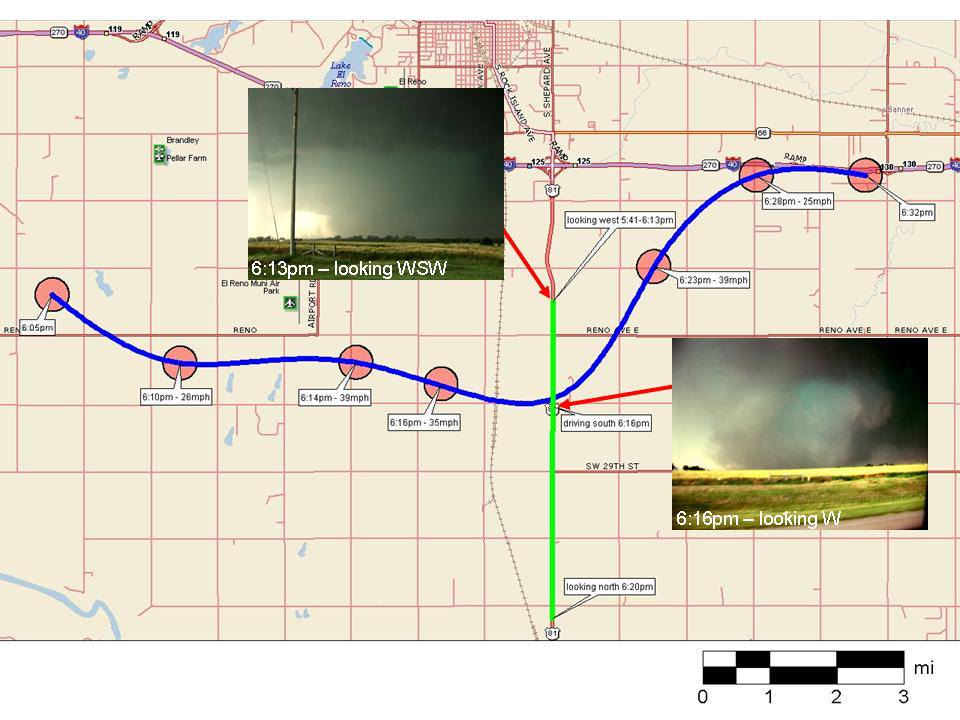 This map is an overview showing our route during the time of the El Reno tornado. |
||
 |
 |
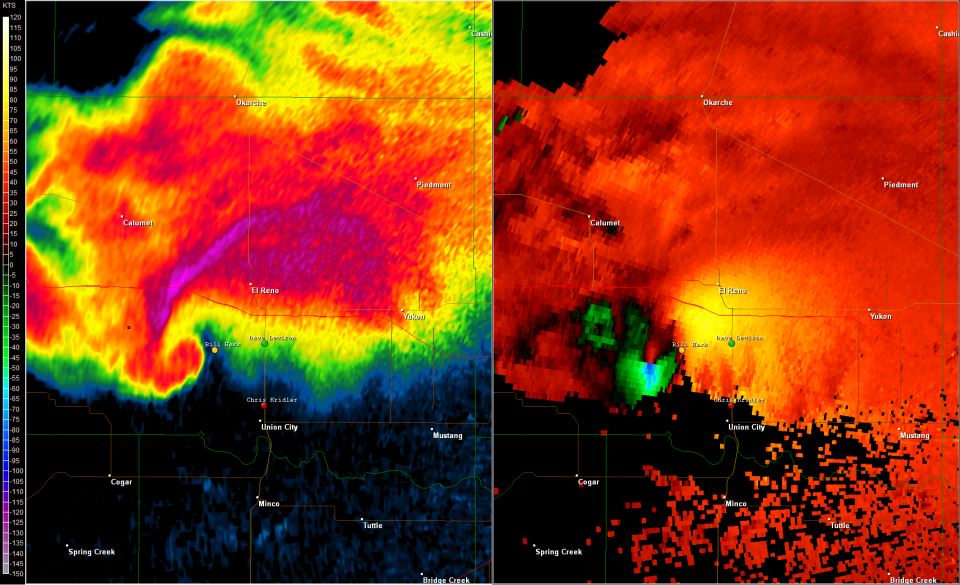
5:45 - 6:05pm - We had come through El Reno and set up at the side of Hwy 81 looking west. We watched as the base took on a classic supercell appearance, although visibility was limited by heavy rain. By around 6pm, the tornado was taking shape west of the El Reno Airport, about 7 miles to our west. We waited and watched as the inflow really began picking up. My location is the green dot. Other friends, Chris Kridler & Bill Hark are indicated. |
 |
 |
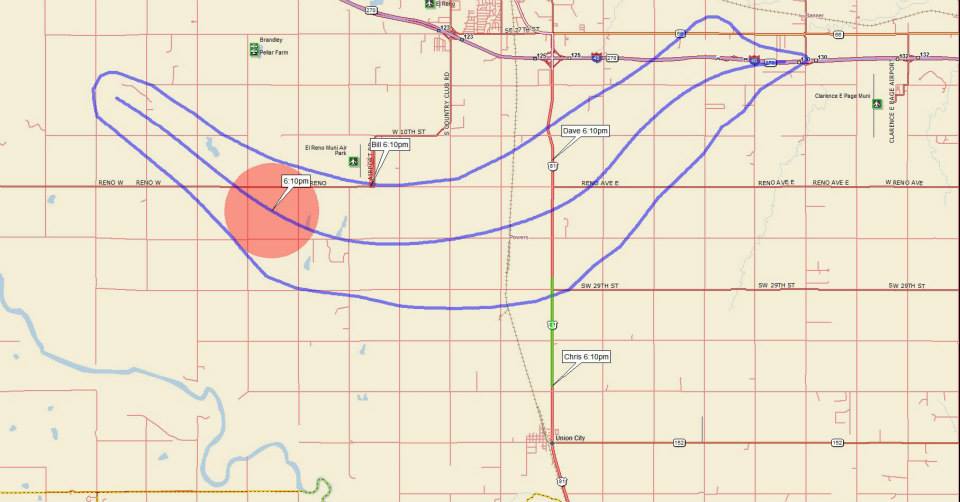
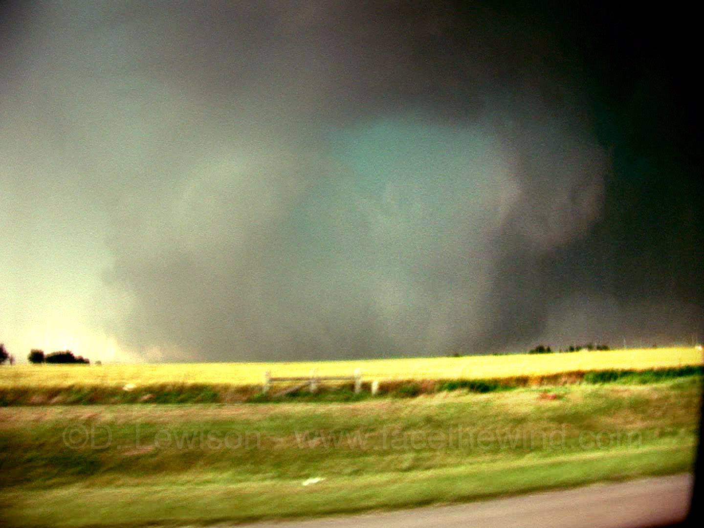
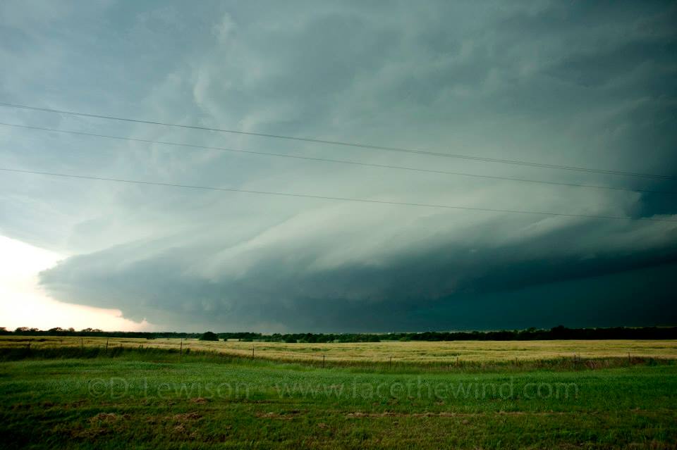 6:10pm - Our view to the west as the tornado planted itself on the ground and began taking a more southeast course. Visibility to the west was still poor due to heavy rain. But the tornado was clearly visible in lightning flashes, (it's a low contrast cone in the center of this image). |
 |
 |
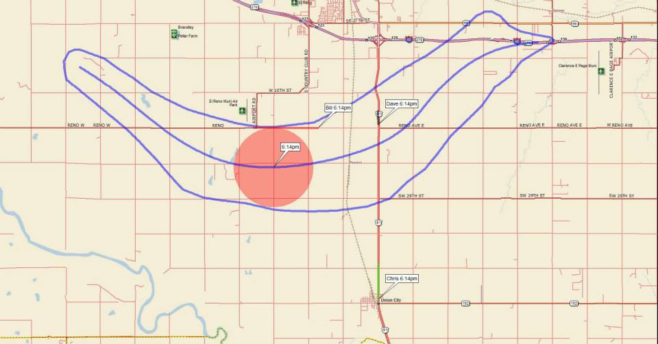
 6:14pm - Anticipating that the tornado's southeasterly course would cut off our south escape road quickly, we bailed from our location, so that we could beat it before it crossed Hwy 81. This is our view to the west as the tornado was about 2 miles away. It crossed Hwy 81 just behind us. |
 |
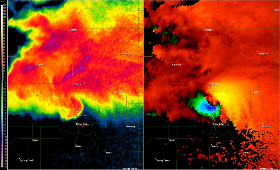 |
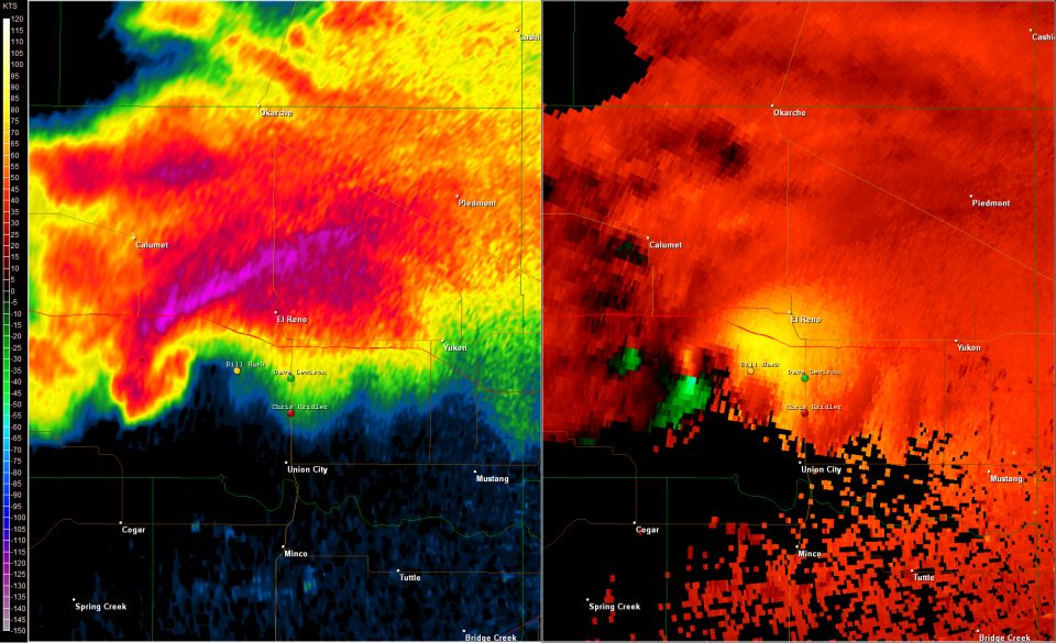
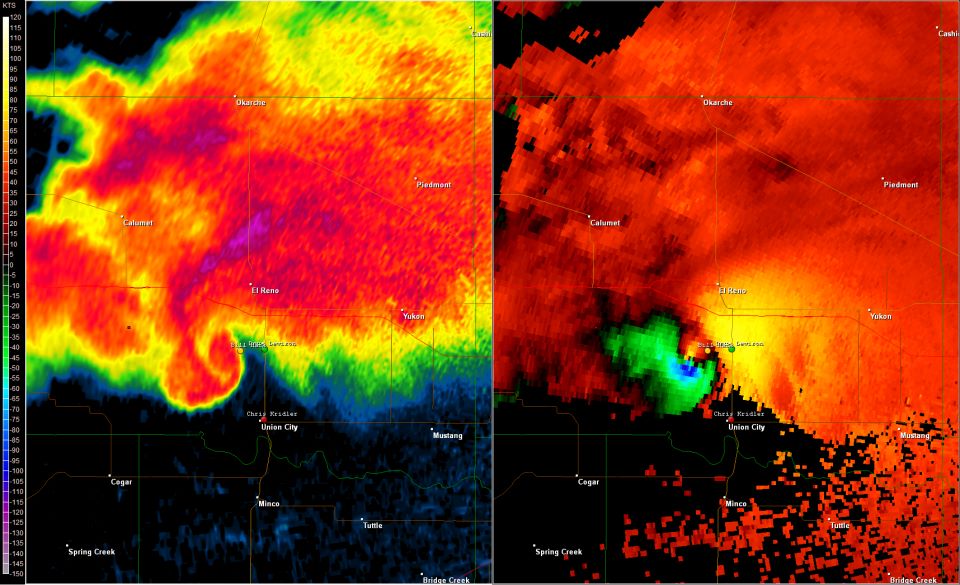
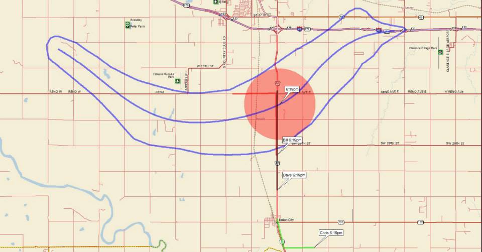
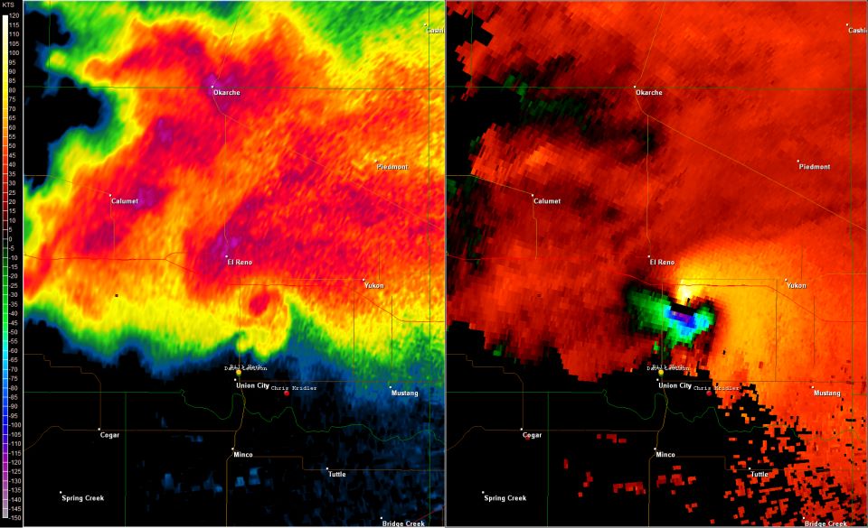
6:19pm - Traffic on Hwy 81 was very slow, despite it being a 4-lane highway. There were many panicky locals, as well as a few chasers, clogging the road. We paused about 2 miles north of Union City, OK to have a look behind us. The view back to the north was a big dark wall of precip that was barely recognizable as being anything. But this radar image shows that a violent and very large tornado was buried deep in the rain. |
 |
 |
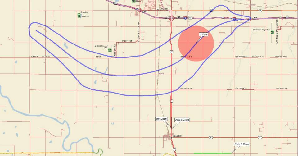
6:23pm - As we proceeded SLOWLY south due to the traffic, a large & violent tornado, now completely obscured by rain, hooked back to the northeast and headed towards I-40. This is approximately the time when it struck the car that well-known storm chasers Tim & Paul Samaras and Carl Young were in, killing them. |
| We kept following south along Hwy 81, keeping a close eye on the new cells going up on the western edge of the complex. But by then, there was a large amount of outflow air that destroyed any chances of further supercell/tornado development. |
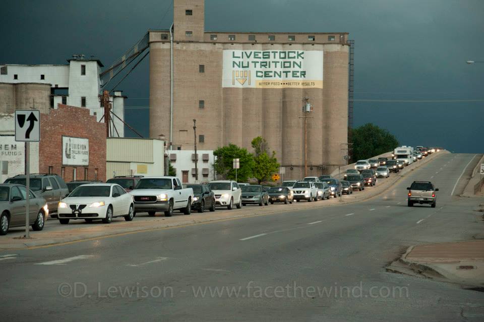 Increasing density of traffic also made travel very frustrating, as more people fled south, despite the danger weakening. This was the scene in Chickasha as what was left of the storm complex approached. |
This traffic lasted well into the night as those who fled south tried to make their way back home to the OKC metro. |
You can contact me at: dave@facethewind.com
