![]()
June 17, 2009
Click above for a video of the Aurora tornado (47MB WMV)
| June 17th - Cyclic Tornado Machine in Nebraska | |
 |
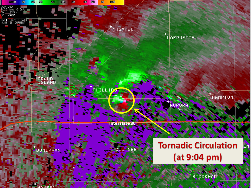
 All I gotta say is "WOW". This is the perfect example of a tornadic supercell radar image. And I was right in the perfect position (where the white circle is). Amazing day! |
 |
 |
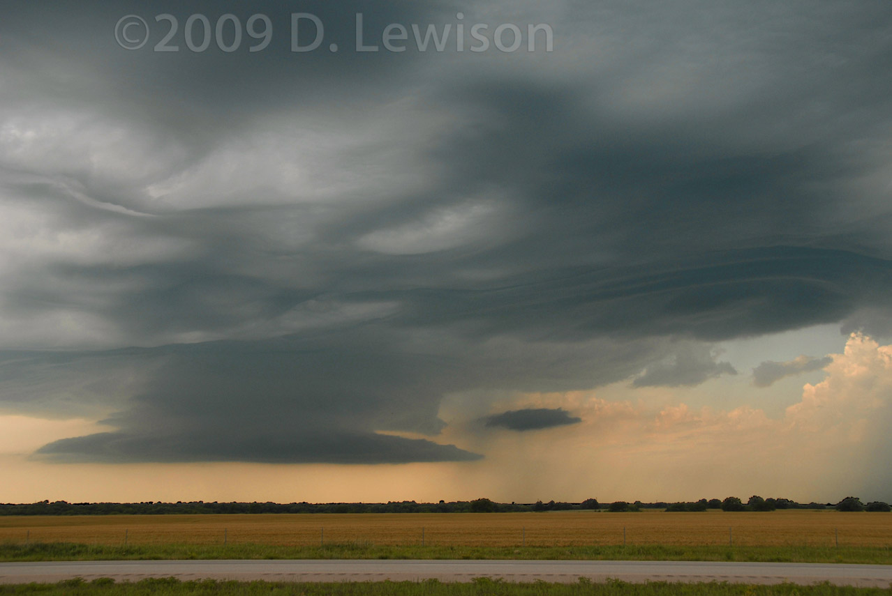
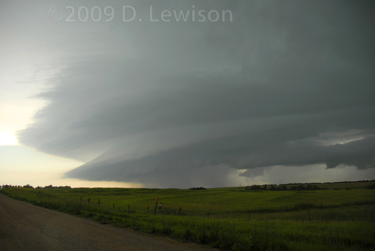
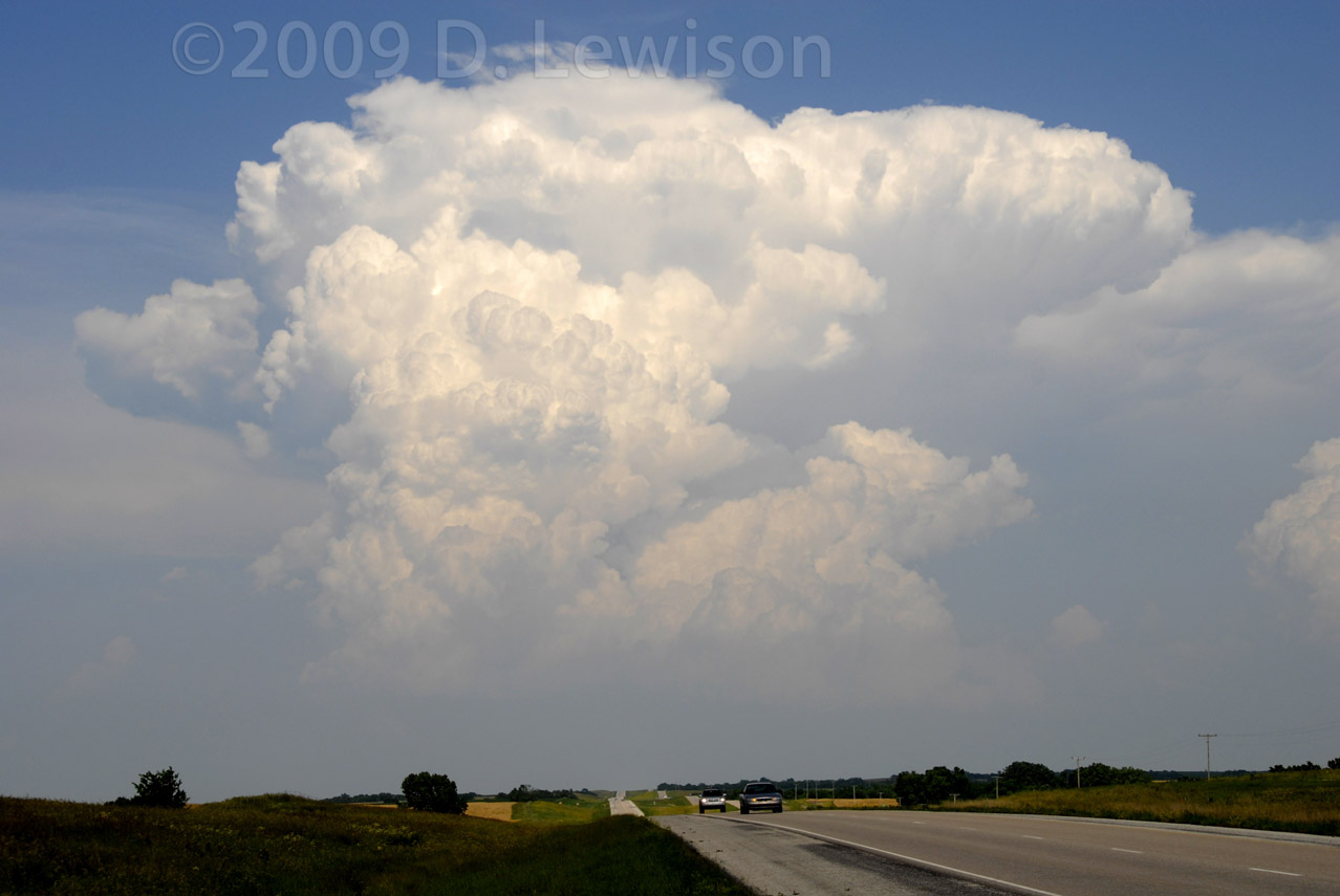
| The first supercell initiated very early...around noon! We were on our way north to the target area of S. Central NE, and we decided to divert to play with this storm for a while on the KS/NE border. Neat cloud patterns! | The storm had numerous menacing lowerings, but had an overall HP outflow-dominant appearance most of the time. |
 |
 |
| West of Pawnee City NE, the storm took on the classic "mothership" HP look. | And the TIV arrives on the scene! |
 |
 |
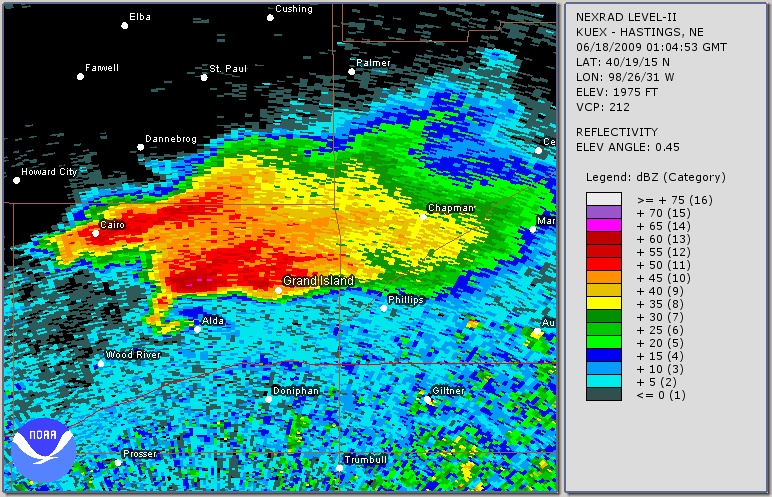
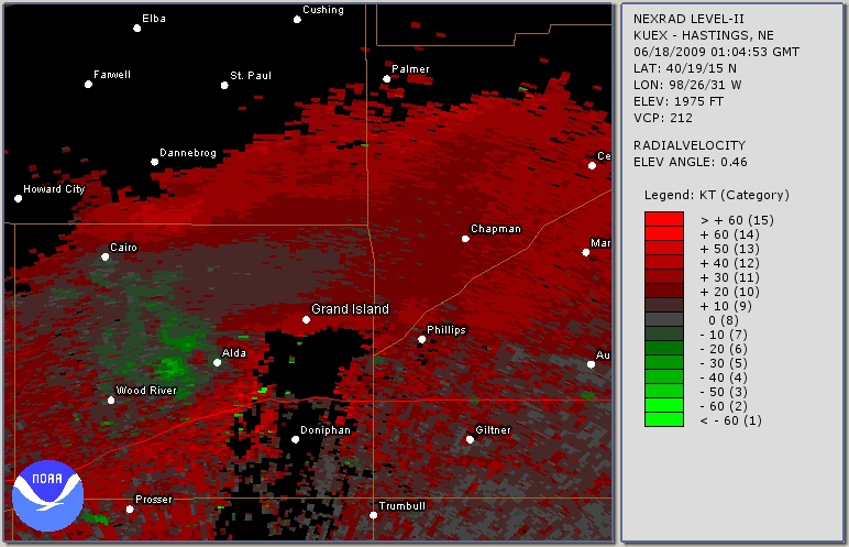
| Radar image of the first supercell at about the time these photos were taken. Textbook HP supercell structure, with massive core and tiny hook/inflow notch. | Doppler velocity image at the time these photos were taken. Not a whole lot of rotation, but there was some. |
 |
 |
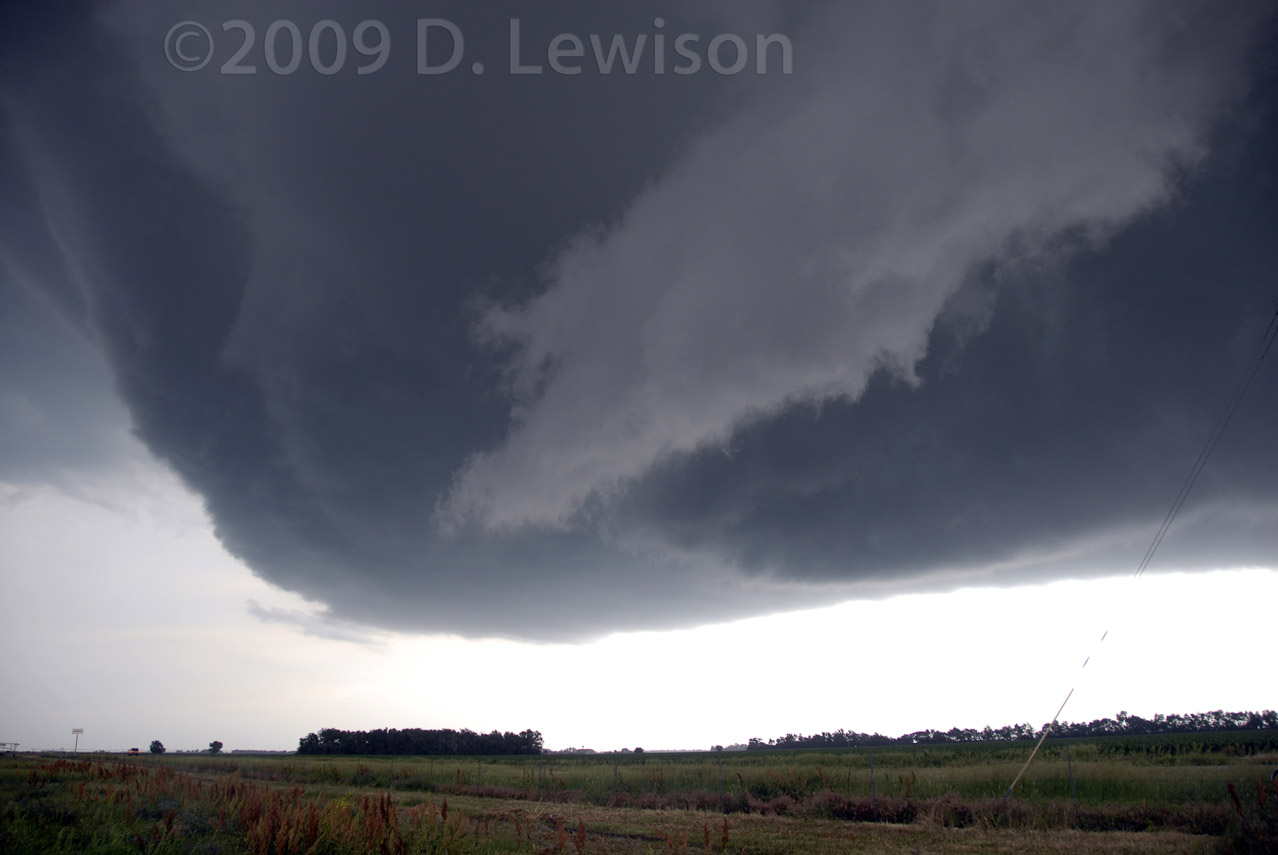
| Near Pawnee City NE, the storm has a sharp inflow band. |
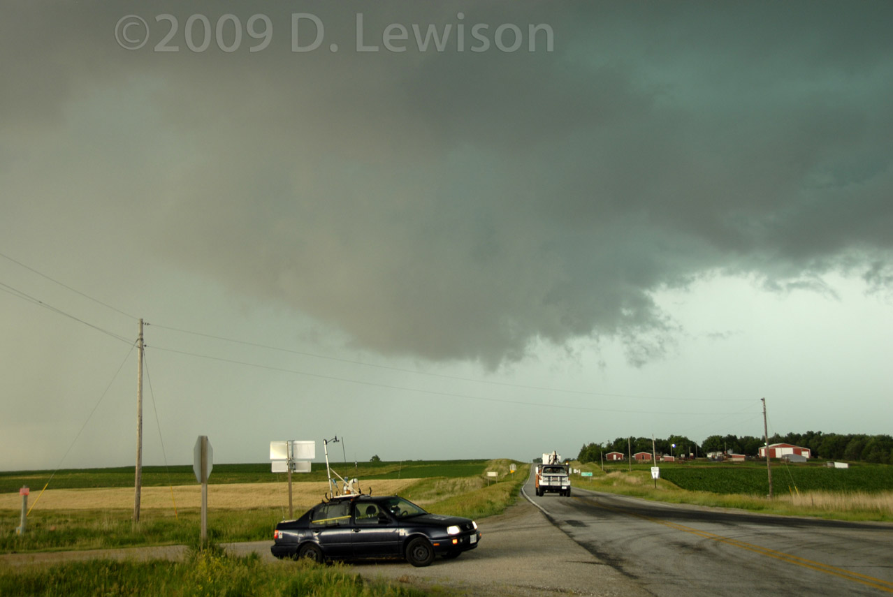
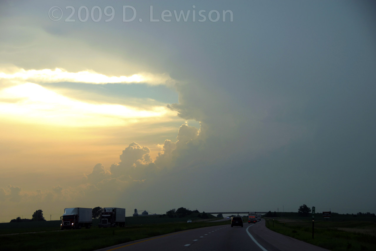
The initial storm became outflow-dominant as it moved into western
Missouri, diminishing tornado potential, so we let it go. On the way
back west to the original target area, we saw this in the rear view
mirror. Do we go for it? Well...it was tough, but we decided to keep going west towards the original target, which turned out to be a GREAT IDEA! |
 |
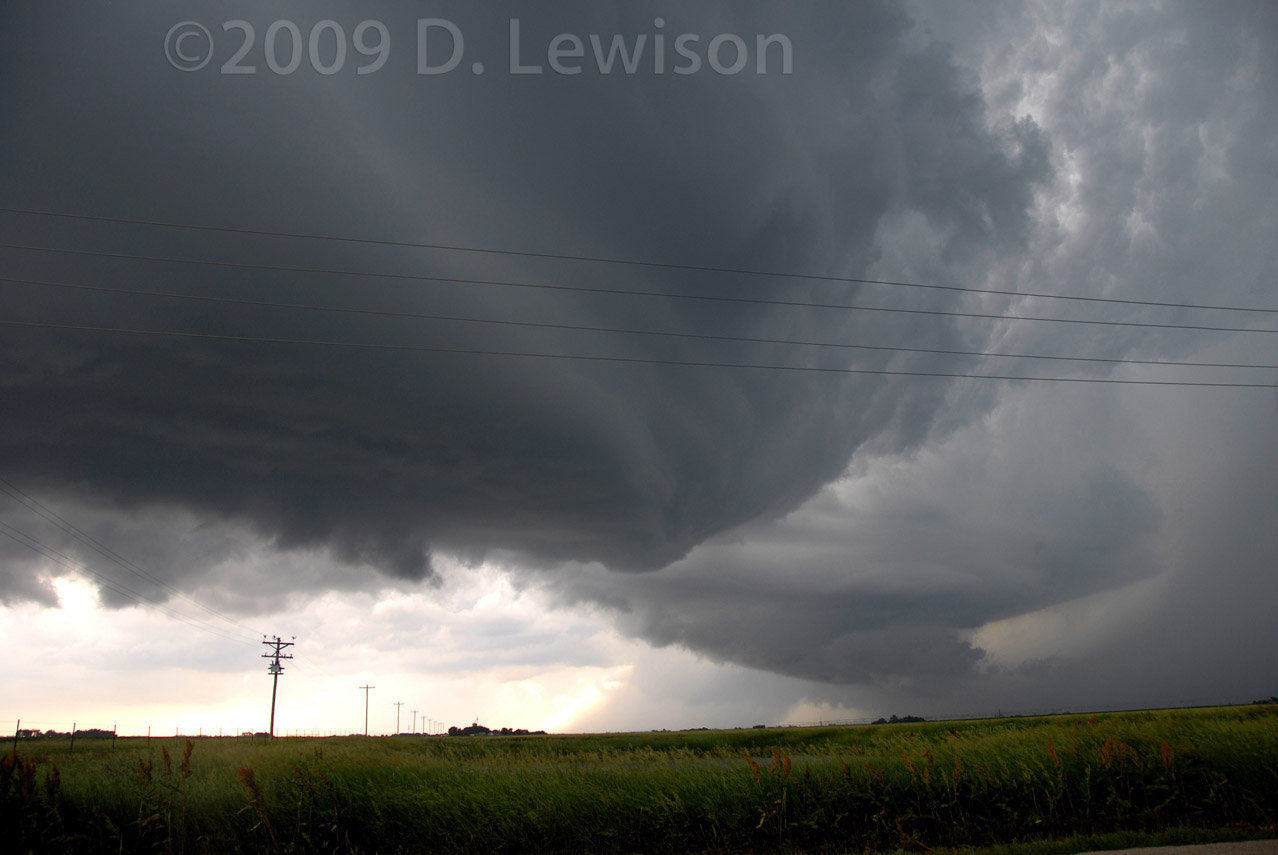 |
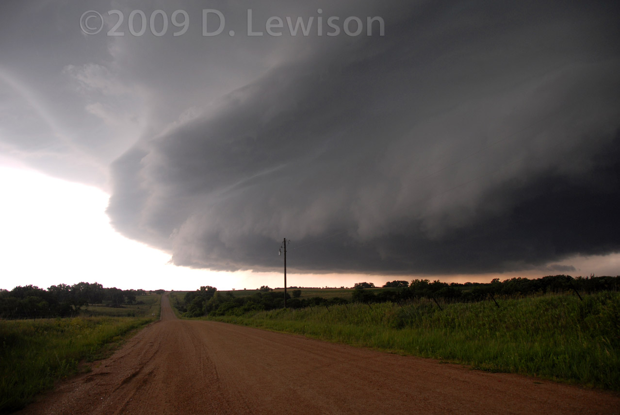
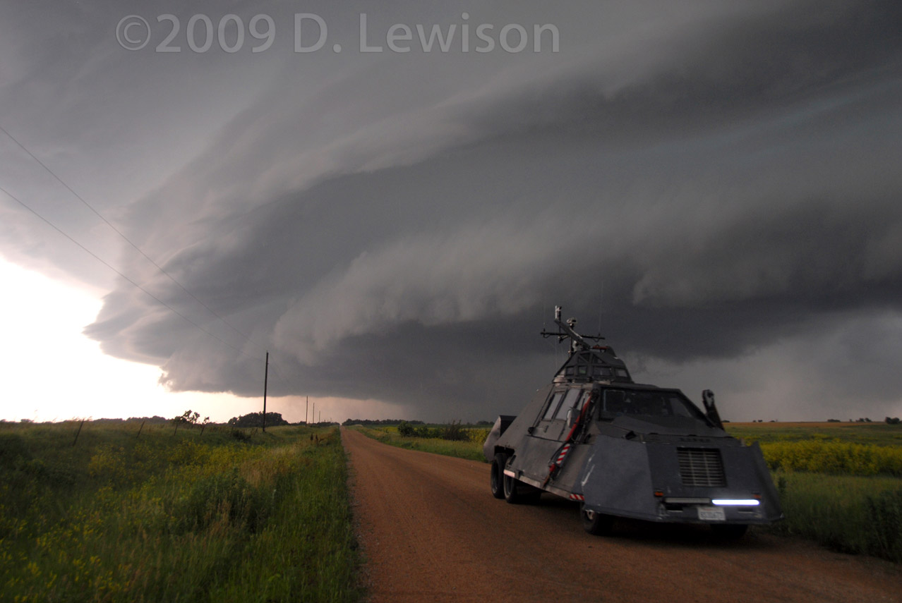
| So, further north and west, closing in on Grand Island NE. Blasting west on I-80, the sharp updraft edge is visible. The storm was producing a tornado at this time that we couldn't see....CRAP! | Finally underneath the updraft base. Looks like two updrafts actually. |
 |
 |
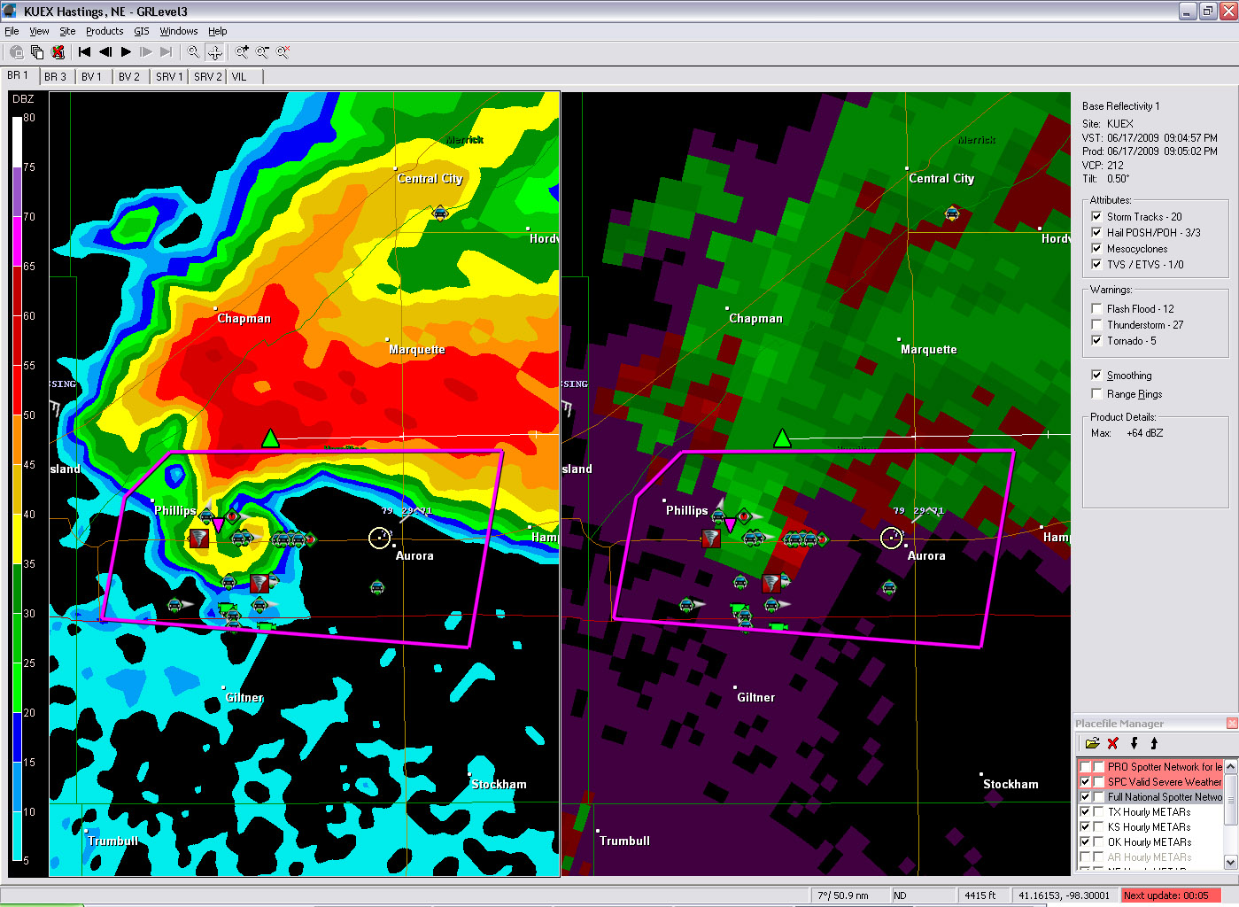
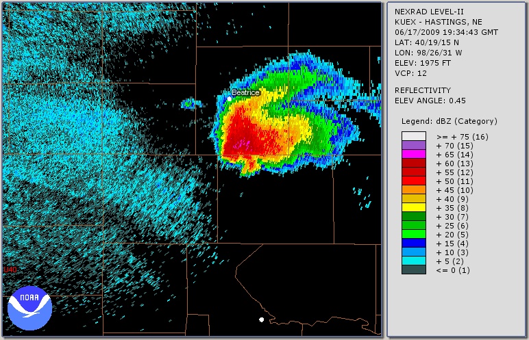
| Radar image at 8:04pm local
time, about the time these photos were taken. Can see the elongated hook
of the meso we were under, as well as the older dissipating meso back to
the west. Both of these mesocyclones are visible in the above photo (2 bowl-shaped lowerings). |
Doppler velocity image at the same time (8:04pm local). The rotation couplet (red/green) is just west of Alda and is slowly gaining strength. |
 |
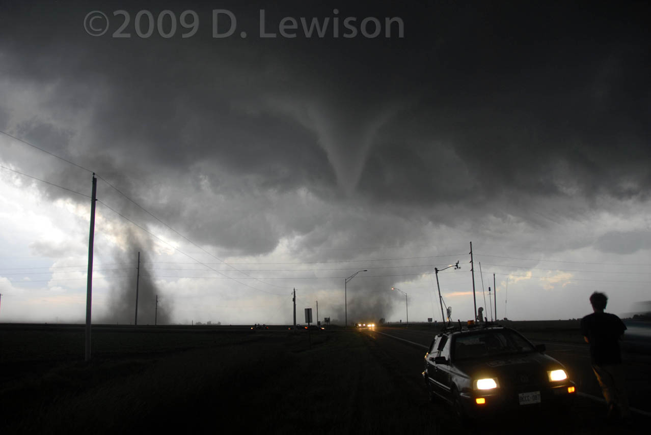 |
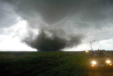
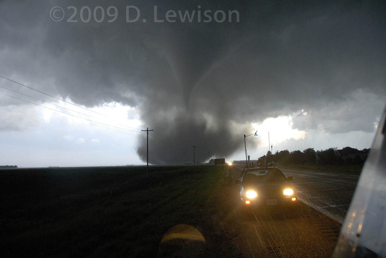
| The closer updraft base gets better organized. Nice inflow tail beginning overhead. This thing was just drifting to the east, so we had lots of time to stare up into the belly of the base! | It didn't take long before it got down to business again! This tornado touched down just west of Aurora NE at around 9pm and began following Hwy 34. That's Mark Robinson behind us. |
 |
 |
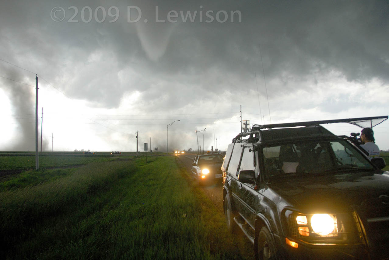
| A few minutes later. Not sure
what that second dirt plume is. RFD? Right at this moment is when Reed Timmer was getting the glass blown out of his "Dominator" vehicle a mile or so down the road. |
A few minutes later, the tornado crosses to the south side of the road. |
 |
 |
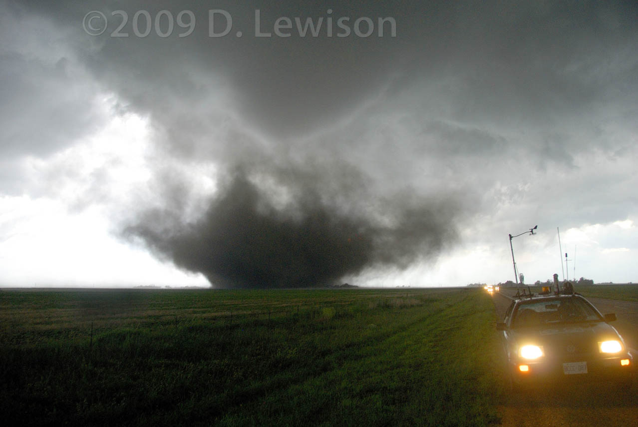
| Still south of the road, the tornado weakens briefly. That's the Iams Dog Food plant to the right of the road. It was sideswiped by the tornado a few minutes later. | The tornado strengthens again, as it weaves back towards the north. |
 |
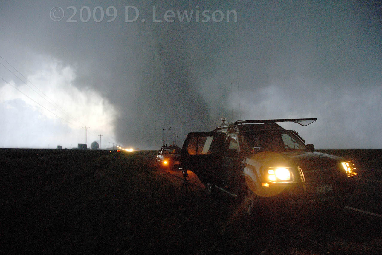 |
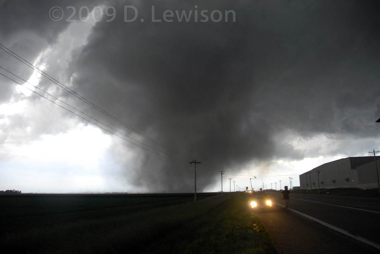
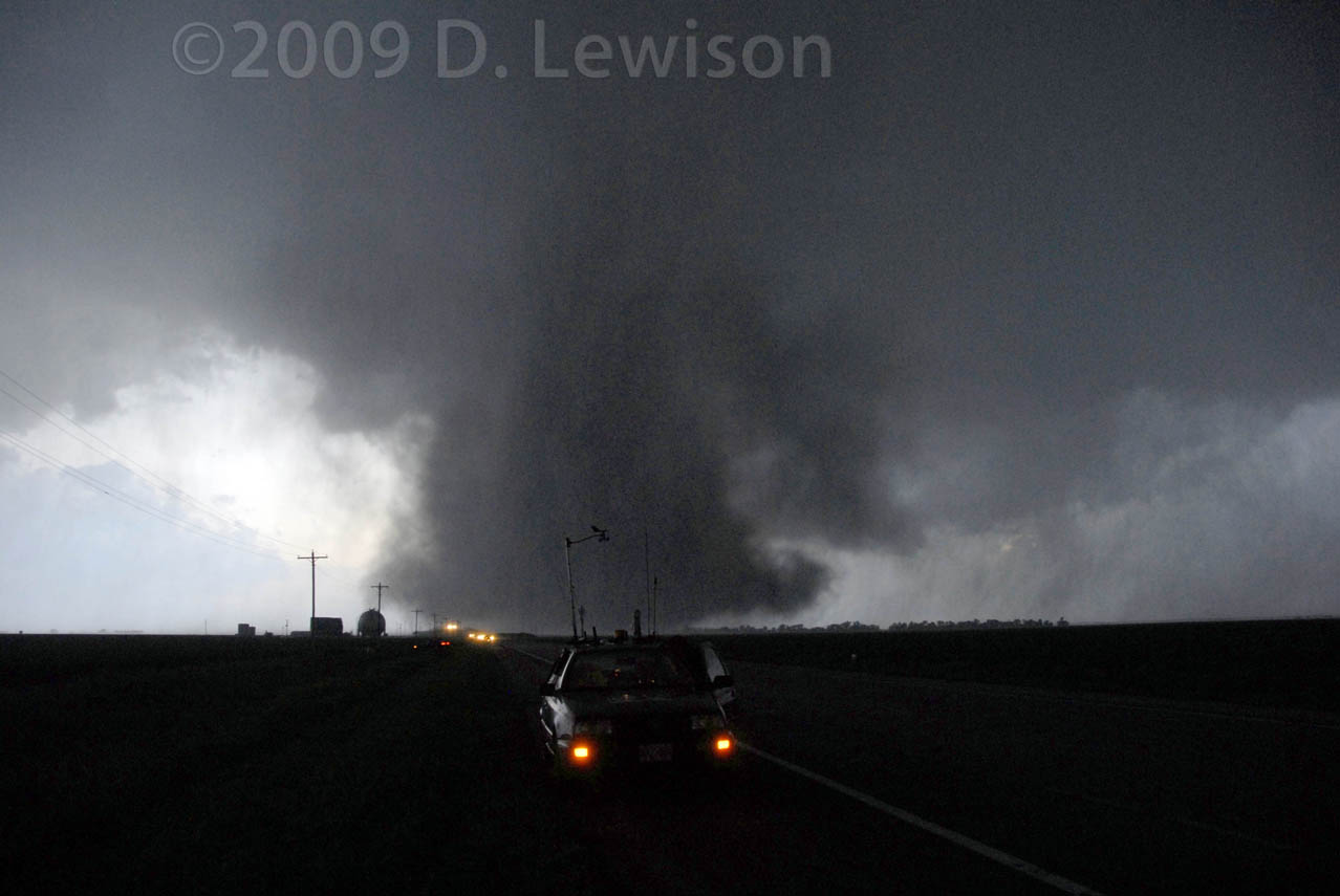
| Still strong, the tornado crosses back over to the north side of the road. | The tornado is well north of the road now and beginning to dissipate. Intense rain from the hook was now falling at our location, and our daylight was rapidly fading. This image was at 9:15pm...The tornado was on the ground for at least 15 minutes! |
 |
 |
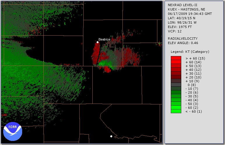
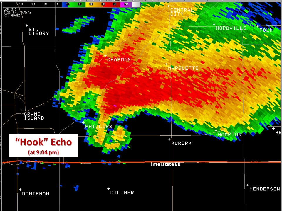
| Wow, what a classic hook echo! We were on the road just west of Aurora. The rain is wrapping fully around the circulation. | Storm-relative velocity image, showing the tight & intense wind couplet, indicating the tornado west of Aurora. |
All Images c. 2009 Dave Lewison. No reproduction without permission.
| Go back to MAIN PAGE |
[an error occurred while processing this directive]