![]()
CHASE SEASON 2005
This is a temporary page where I'll post short logs and pictures.
MAY 7, 2005. Supercells & tornado in south-central NE.
  |
Started the day in Colby KS, with a
target of Kearny NE, ahead and northeast of progged
dryline bulge. Parameters were not great...Td's of only
55 or so, southerly surface and 850 winds making for weak
directional shear and lack of a clear focus for
convergence along the dryline. CAPE was not progged to be
very high either...only 1500 or so. But, due to the
expected local backing of the winds near the dryline
bulge, we thought this target was as good as any. We
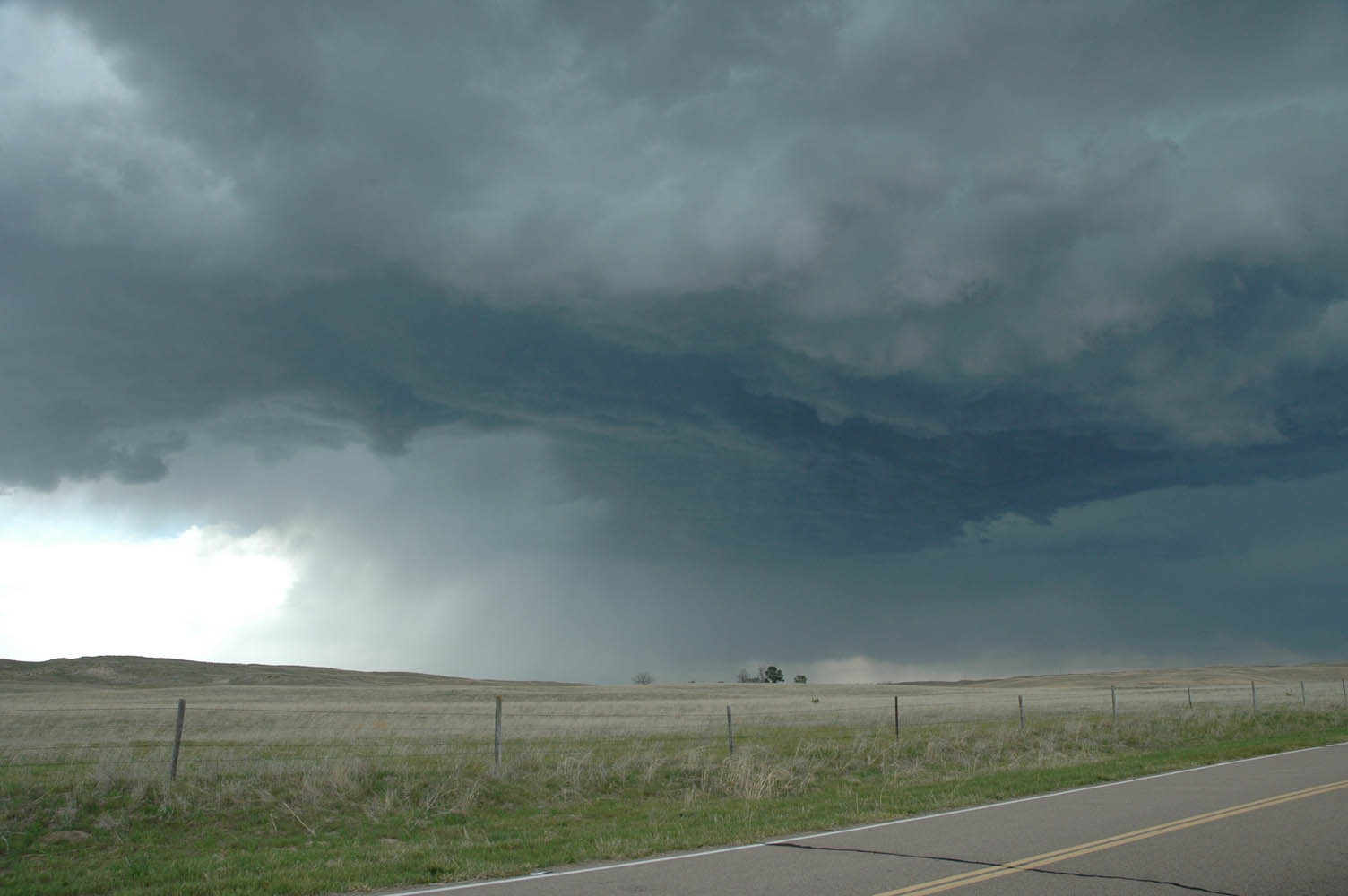
headed northeast up 383 and then 183 to I-80. First cells of the day fired to our west near N. Platte, so we drove west to intercept. Near Maxwell, we met up with one of the cells. It looked rather high-based, and the RFD wrapping around was very cold. In west winds now, we were clearly behind the dryline, so we went back east towards Kearny. |
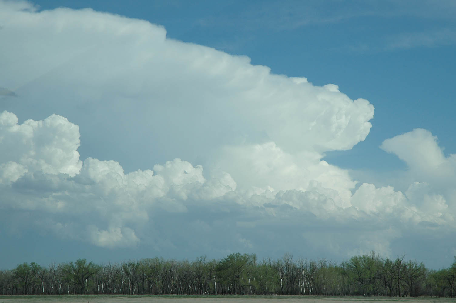     |
Along I-80 we was explosive development
south of Holdrege. We continued eastbound, taking the
Odessa exit so that we would not run into the core on the
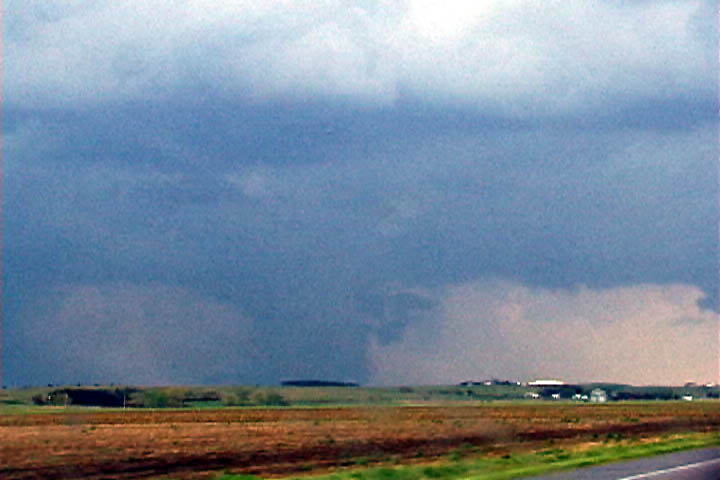
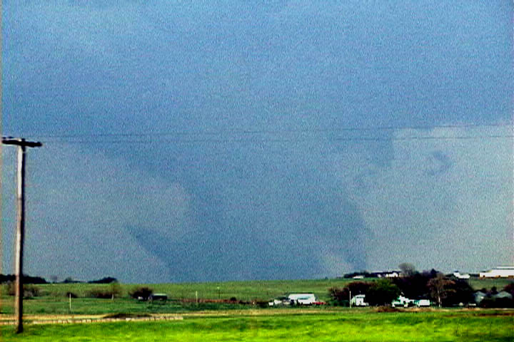
Interstate. The base on this storm looked much lower and a very prominent lowering came into view on hwy 30 just west of Kearny. It was difficult to discern if this was indeed a tornado for quite some time, due to the scuddy appearance and our distance (about 5 miles). Only after hearing corresponding reports of a tornado on the ground did we realize that it truly was a tornado. View here to the northeast...images slightly contrast-enhanced. After following this storm up northeast of Grand Island, our road network turned sour, with nothing but gravel roads leading to where we wanted to be. The storm also looked very outflow dominant, despite the continuous tornado warnings. There was also very little visibility in the area of interest beneath the base. So, we let it go. |
 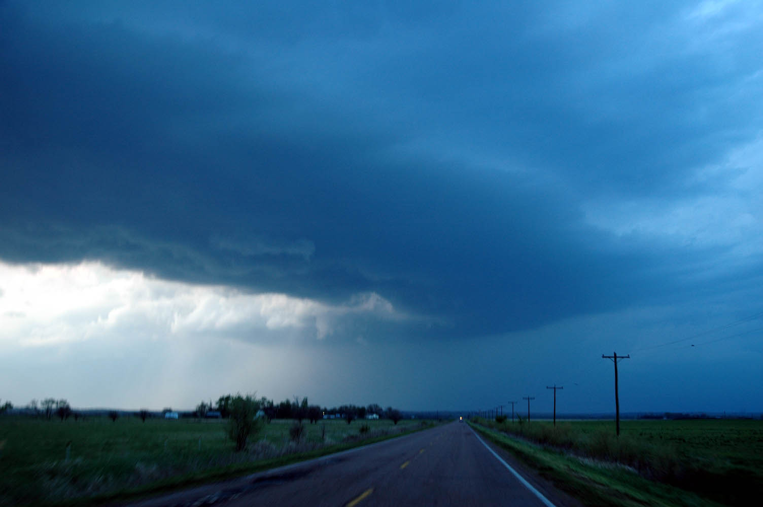 |
However, just SW of Palmer NE, another cell developed right behind it and soon became tornado warned as well! It was a beautiful sculpted updraft with a classic RFD intrusion. It produced a brief funnel, but nothing more. |
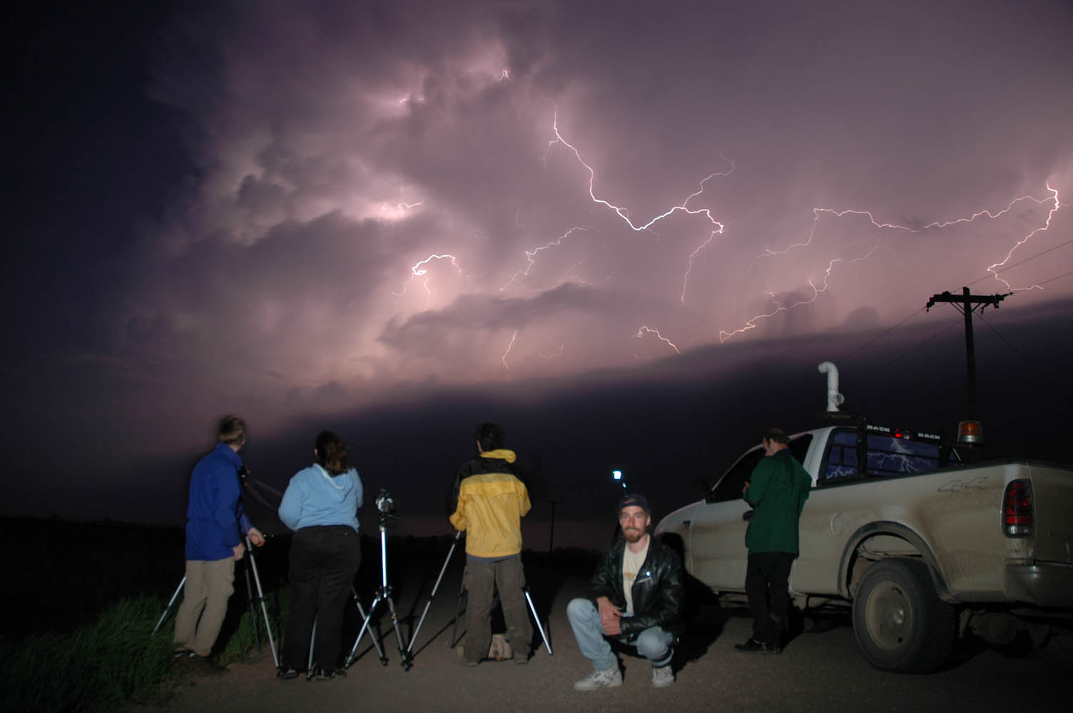 |
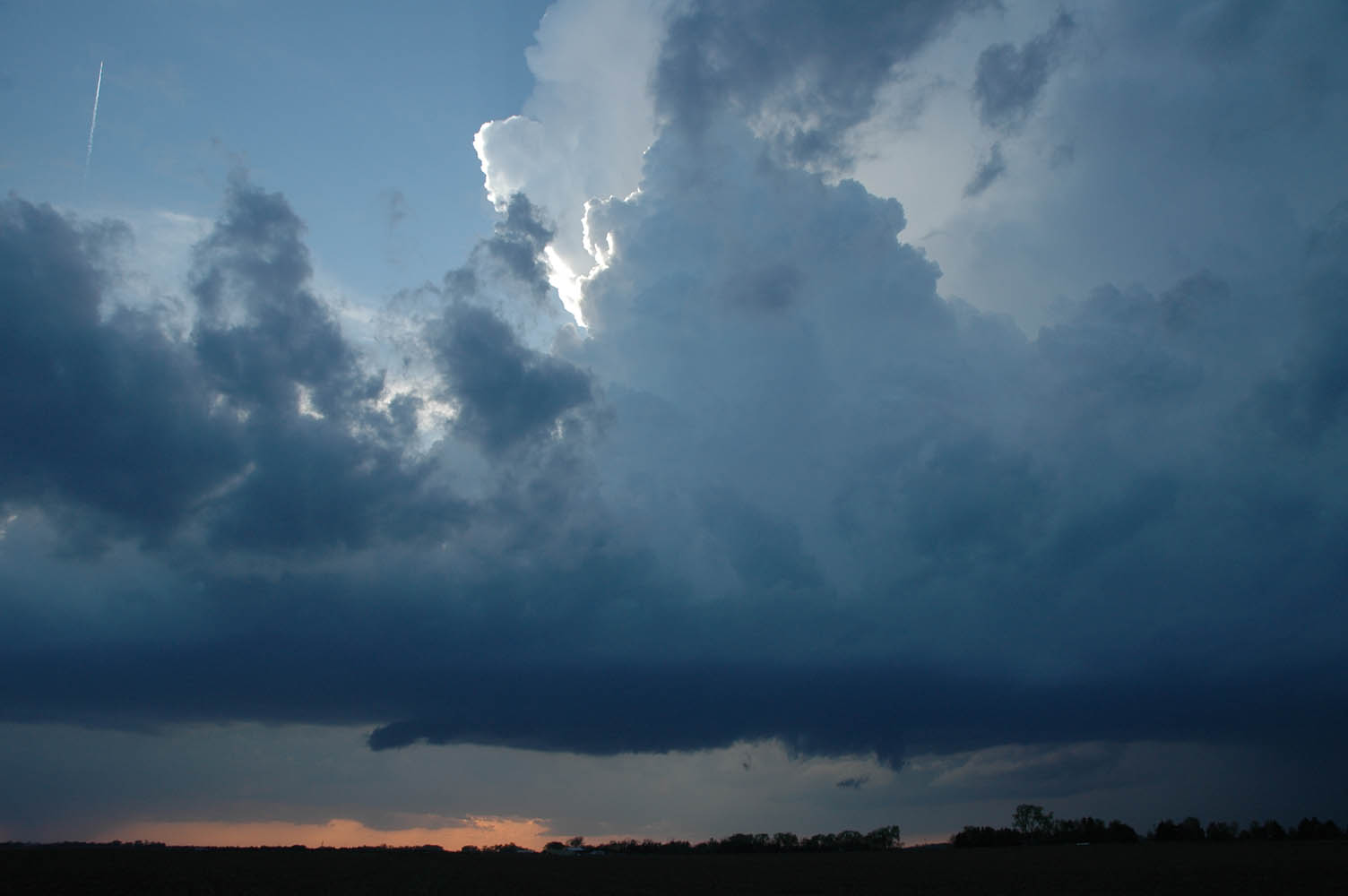
This storm merged with several others to
form a line with an absolutely incredible lightning
display! Spending the night in Grand Island... |
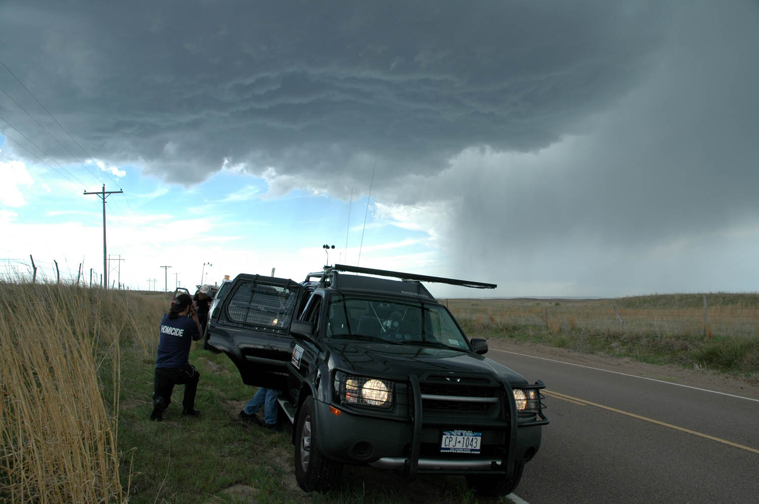
One thing of note that happened today...a few local "chasers" latched onto our vehicle like glue when we were on a storm north of Palmer NE. Cigarettes and beers in hand, these guys obviously weren't out for the purpose of reporting storms. Later on, we ran across them again, mired hopelessly in muck on an impassible dirt road. We stopped to help, despite the rapidly approaching cells to our west, which could have gotten us ALL stuck. After unsuccessfully trying to get their vehicle unstuck, we gave them a ride to the nearest town. It worked out all right this time, but I just know that one day one of these folks will get themselves killed by chasing in this manner, and the media will have a field day, casting an unpleasant light on all chasers...A very scary thought...
Chasers in the group:
| Scott McPartland (Queens NY) |
| Pete Ventre (Queens NY) |
| Chris Kridler (Florida) |
| Mark Robinson (Toronto, Ontario) |
| Dave Sills (Ontario) |
| ...and myself (Mid-Hudson Valley NY) |
All Images c. 2005 Dave Lewison. No reproduction without permission.
| Go back to MAIN PAGE |
[an error occurred while processing this directive]