 |
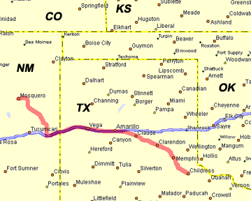
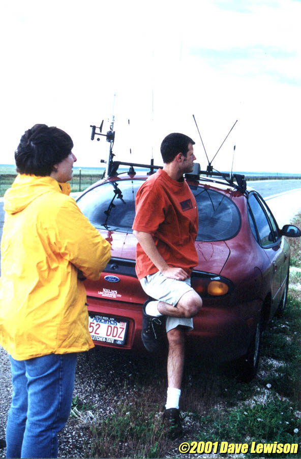
Started the day in Childress after the previous day's "outbreak" in the TX panhandle. We decided to blow off the MDT Risk in the OK Red River Valley due to southwest winds at the surface creating a relatively poor shear environment. Decided that the Colorado/New Mexico upslope would provide a better environment for supercells, although moisture was a bit limited. On our way west, we met up with Scott Blair and Jason Politte in a Taco Bell in Amarillo, so we decided to play our luck together on the front range again. Around 2pm, the first cell went up around Springer, NM, and quickly formed a backsheared anvil. Nowcaster Philip Flory said this was a decent looking cell and was isolated, so we decided to intercept it. |
  |
We pulled off just north of Mosquero to have a look. It had a weak mesocyclone, but it looked rather linear. At this time, another decent cell went up to the south, so we decided to drift back south, and keep an eye on both storms. |
 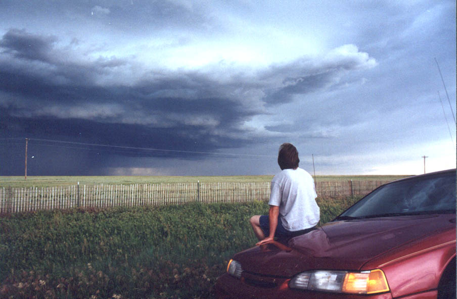 |
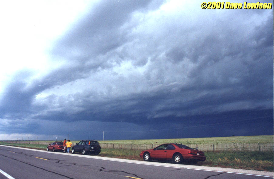
The original storm to our north, while linear-looking, was still photogenic, and we all took the opportunity to take some pictures and talk. |
 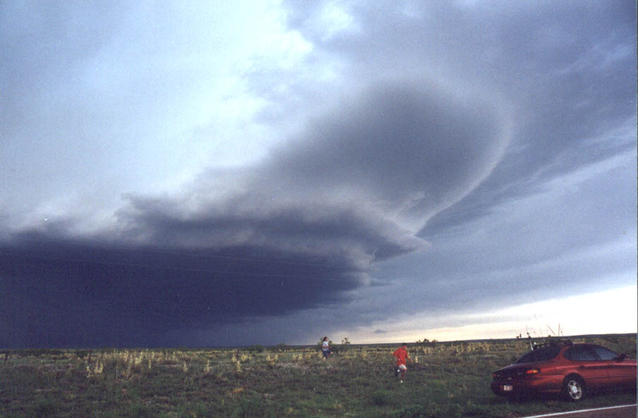 |
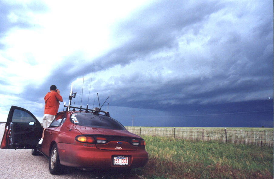
A bit further southeast, the storm developed an intense
rain/hail core. As it drifted southeast, we would pull ahead of it, take pictures, wait
for it to come close, and then move again. Once off the mesas of NM, the storm began to develop some mesocyclonic banding structure. There is even a small wall cloud off in the distance to the left. |
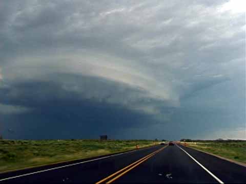  |
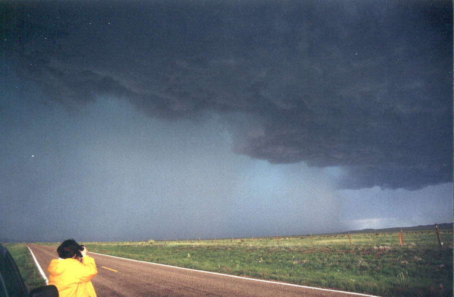
Halfway back to I-40, we noticed that the cell
had become much better organized, with a decent meso and nice banding. This meso soon
occluded off with a hail curtain wrapping around. Before long, another meso took shape. We
turned northeast on 54 in Logan to investigate this structure, including a lowered wall
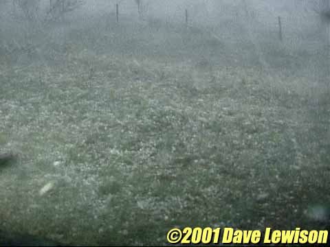
cloud. It, too, wrapped up quickly in rain and hail, so we turned around and tried to get south and east of it. Heading east on I-40, the next meso took shape off to our northeast. Here's where the problems started...We underestimated the speed at which these mesocyclones wrapped themselves up in rain and hail. On the south side of the updraft, we could see right underneath it to the east. There was a rotating wall cloud nearly above. As before, the hail began to wrap around the meso, but even quicker than it had done before. Apparently, we were a bit too slow...We had just entered TX, and there were no south roads to get away. The core wrapped around to our west, cutting off any escape route. |
 |
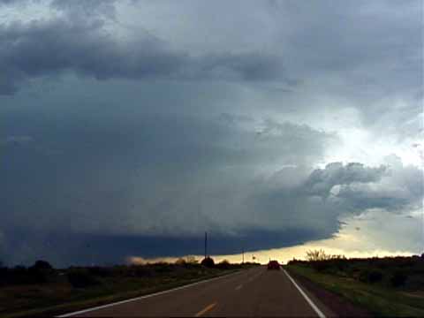
With us blasting east on the interstate at
nearly 90 mph, and clear air only a few miles down the road, the first dime-size hail
hit...followed by golfballs, and then the dreaded baseballs. The windshield cracked almost
immediately...we all had to pull over and wait it out. The cars were rocked by at least 70-mph gusts and horizontal baseball and golfball-size hail. |
|
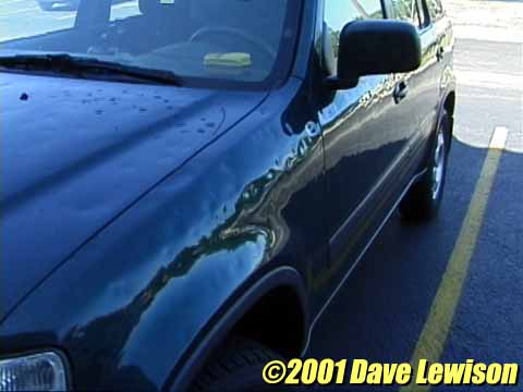
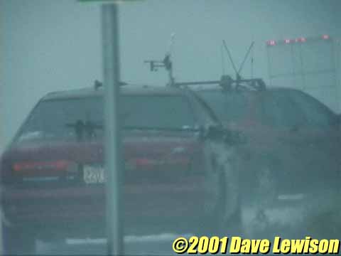
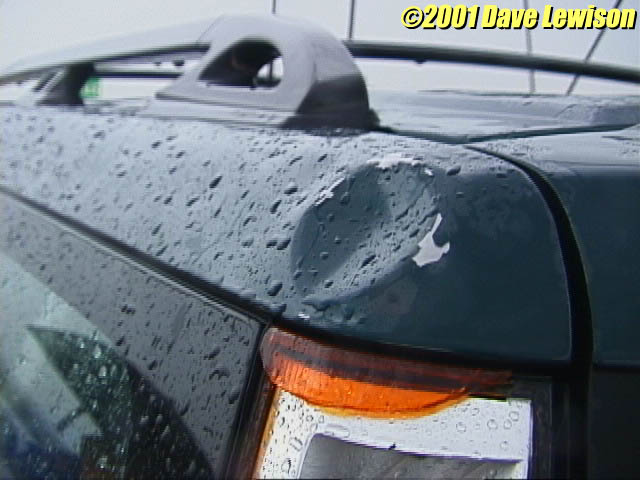
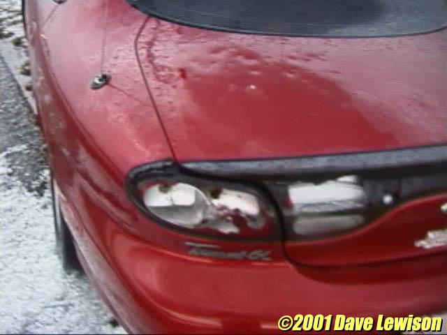
Jason lost his antenna rack, and windshield
wipers. Scott lost many antennas and his tail lights. We cracked a windshield and lost all
tail lights on the left side of the vehicle...All of us sustained major hail dents. We were picking pieces of our vehicles up off the embankment for quite some time... Jason's left turn signal lamp and hubcap were battered off his car. |
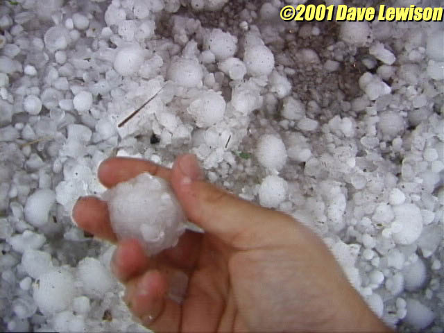 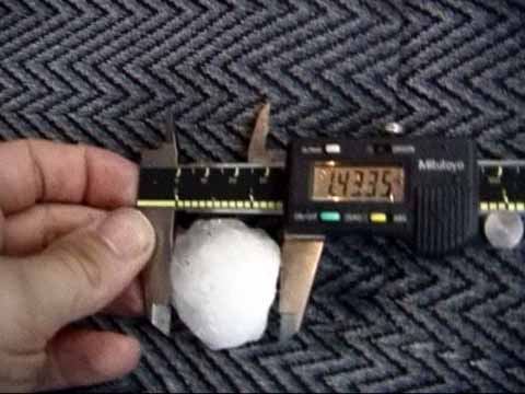 |
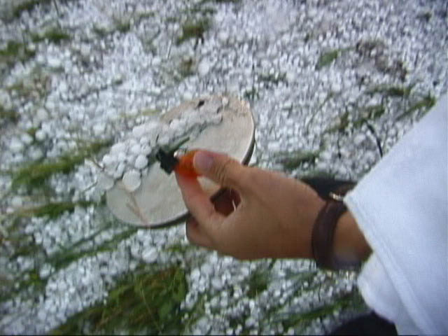
20 minutes later, I got out and measured some hail. They averaged around 1.5" in diameter, but there were a couple chunks up near the 2" range. Softballs were reported just 2 miles to our west. |
|
|