
 |
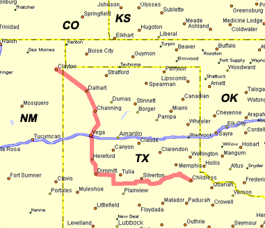
Started the day in Clayton, NM, after the previous day's exhilarating chase in Trinidad, CO. I usually get
very nervous when the day shows a lot of potential, and today certainly had that going.
SPC was all hyped up about long-tracking dryline storms, and had issued a hatched 10%
significant tornado threat across the TX panhandle. Our original target for initiation
this day was in the Amarillo to Plainview corridor. After checking data at a very friendly computer store in Dalhart, there appeared two target areas. I originally liked the area along the OK/TX panhandles because the best helicities were in that area. However, earlier convection in that area was limiting the heating. We decided to head south where there was better instability. In mid-afternoon, we stopped in Vega for some more data (and a corndog for me). We hung around there for about an hour, periodically logging in. At about 4 pm, satellite was showing a small group of towers beginning to pop northwest of the Plainview area, so we decided to pack up and see what it had to offer.
|
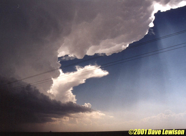  |
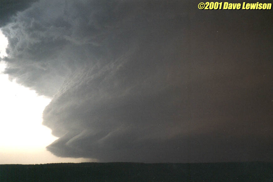
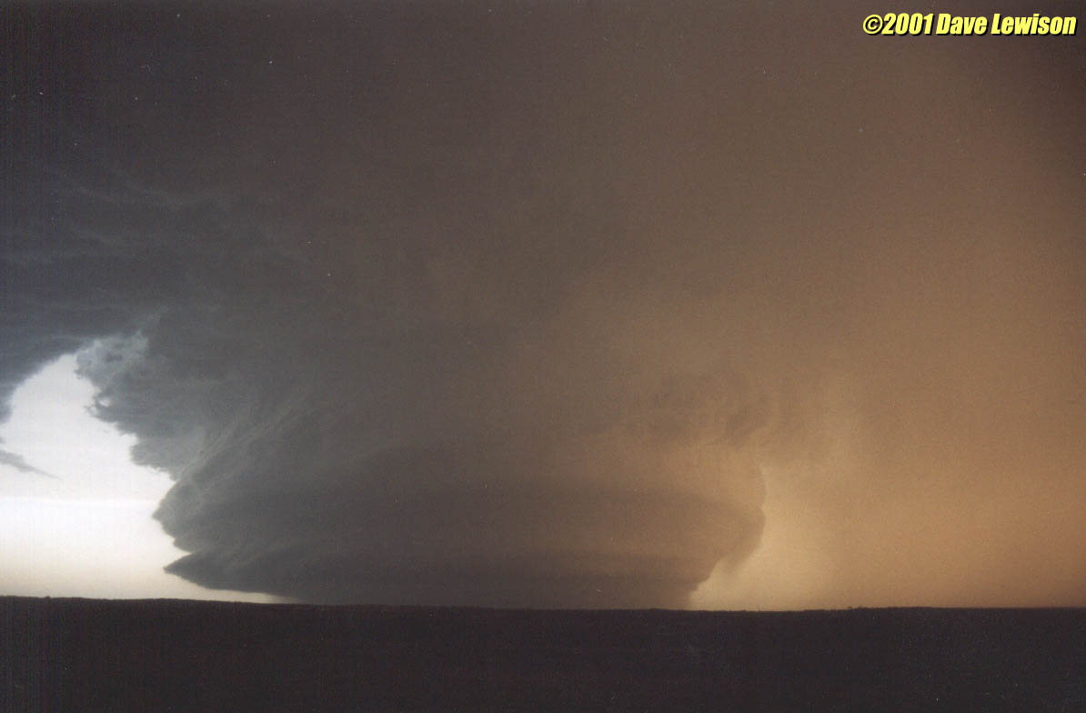
It apparently was a splitting storm, with the left split
weakening rapidly, so we continued pursuit of the right-split. It had a stout updraft with
cumuliform anvil. Very nice! The storm was very linear-looking for quite some time. Once it neared the caprock, just SW of Silverton, it began to get better organized, with a bowl-shaped lowering just to the north of Ranch Road 145. An RFD blast kicked up a large amount of dust heading towards this feature, tightening up the circulation. We though it was about to plant a wedge at any moment. It tried really hard, but never produced anything...at least not from our vantage point. |
  |
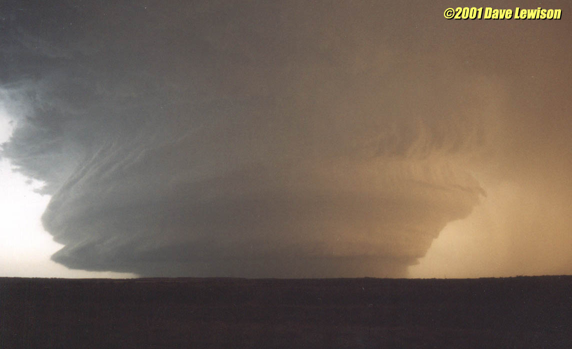
Heading SE on 86 towards Quitaque, the storm was pulling in
an incredible amount of red dust from the surrounding fields. This storm meant business,
however there was a lot of precip in the base, making it hard to pick out any features.
There were reports of brief spinups, but we never saw any. As 86 curved back NE towards Turkey, we got a closer look under the base again. There was definitely strong storm-scale rotation, but we didn't see any obvious lowerings or tight circulation. Rain wrapping in made visibility very poor. Ugh, I hate when nice cells turn into HP bombs! |
 |
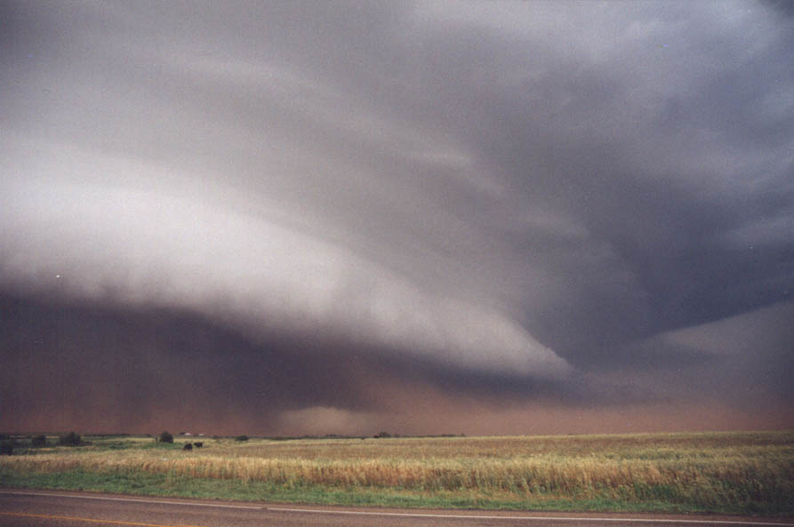
We continued to pull ahead of the storm heading NE on 86,
mainly because we wanted to get to a SE road option (287) so we could observe without the
fear of being munched by the hail core. The meso was getting better and better defined.
|
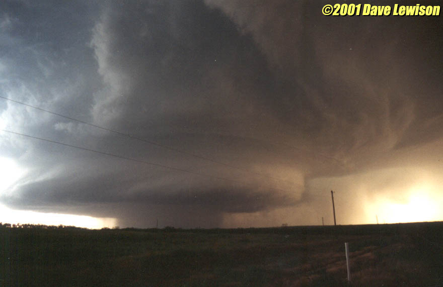  |
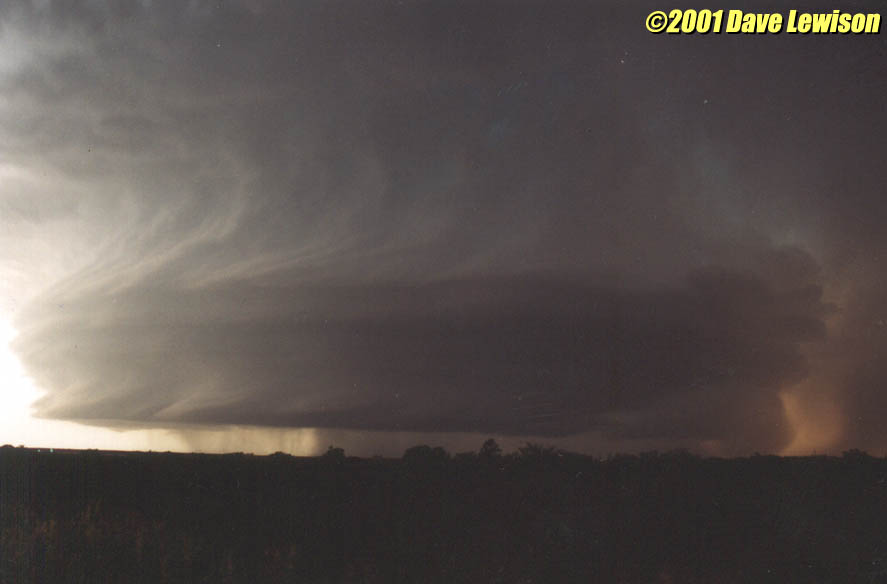
Near Parnell, we were treated to the most gorgeous mesocyclone I'd ever seen! |
  |
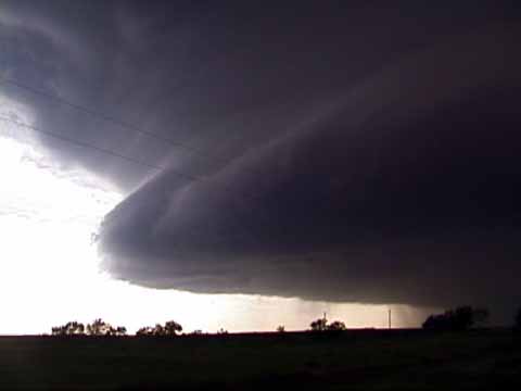
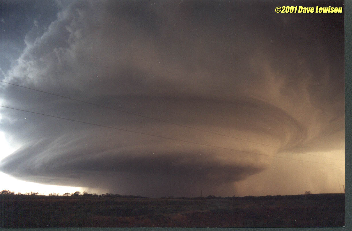
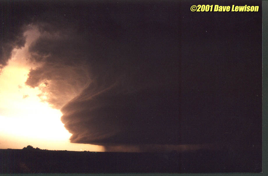
But wait! There's more! A bit further east, and now stopped along 287, we saw a jaw-dropping HP barrel mesocyclone, complete with multiple tiers, striations everywhere...I was speechless! I burned through an entire roll of film in less than 5 minutes. |
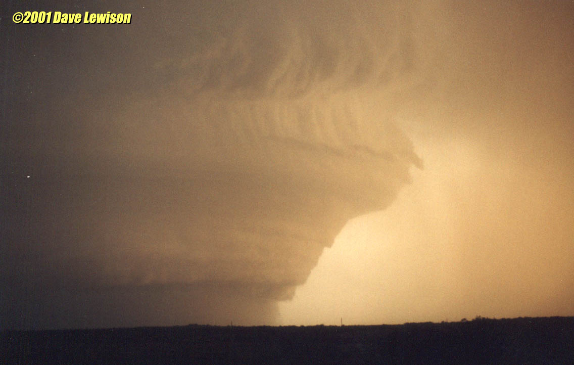 |
The structure was amazing. It truly did look like an
upside-down wedding cake. Surely this was something that had been sculpted by an
artist...not a natural cloud formation! I kept snapping photos, shooting every possible exposure and zoom framing. I wasn't gonna miss any of it! I ran out of film and didn't even bother to reload....I just sat in the car while Chris finished her film...I couldn't stop staring at it. If there was a tornado in there, there was no way we could see it with all the precip below the base, but I honestly didn't care! |
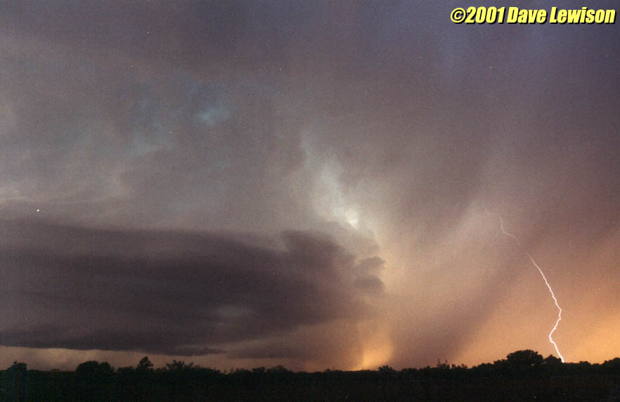  |
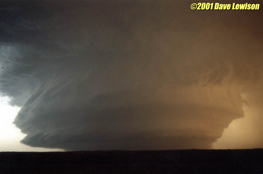
Further SE near Childress, we stopped again to watch the meso approach, amidst the blaring tornado sirens. I can't imagine what the people who live there thought when they saw this "doomsday" meso bearing down on them. It was an amazing sight. I managed to capture one of the lightning bolts in the vault region on 35mm film. |
 |
Finally, we retreated back to Childress as the storm came closer and the sun began to set. We hid under a gas station in case there were any baseballs flying, but we just got heavy rain. Thinking there might be baseballs coating the road further south, we investigated, but ran into some quarter-size hail still falling, so we chickened out and turned back. We crashed at the EconoLodge in Childress...Time to call it a day. |
| Two great days in a row! Today we didn't even see a tornado, but I consider it the best looking storm I've ever seen. | |