|
Started the day in Amarillo. Our best hopes appeared to be
towards the Oklahoma panhandle into SW Kansas, so we decided to head up 60 to Pampa, and
then north to Perryton. We ran into major chaser convergence at the local "Waterhole 83". Roger Edwards & Dave Gold with Silver Lining Tours, Charles Edwards & Jim Leonard with Cloud9 Tours, Gene Rhoden, and a number of other chasers soon showed up. The lack of any reliable data at this location was a problem, but we peeked over Jim Leonard's shoulder at his laptop because he had a cell modem connection. Best moisture was pooling to our north in Kansas, but veered out surface winds limited our hopes. |
|
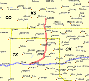
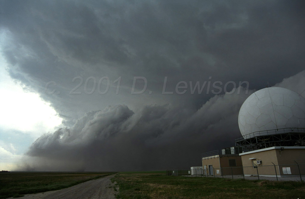
We stopped at another truck stop near Sublette to pull up some
more data. A squall line was setting up about 100 miles to our north and was picking up
speed southward. We drifted up the road a bit and found a nice place to watch the
approaching gust front. A radome south of Garden City seemed like an ideal spot. We hung out here for a while as the front approached, kicking up massive amounts of dust. There were even a few gustnadoes that spun up along the front. The one here is visible as a dark cloud of dust in the lower center of the frame. I am not sure if the curly cloud structure above it is actually connected, but it wouldn't surprise me. It looks like a gustnado formed and then was kicked out by the southward push of the front. |
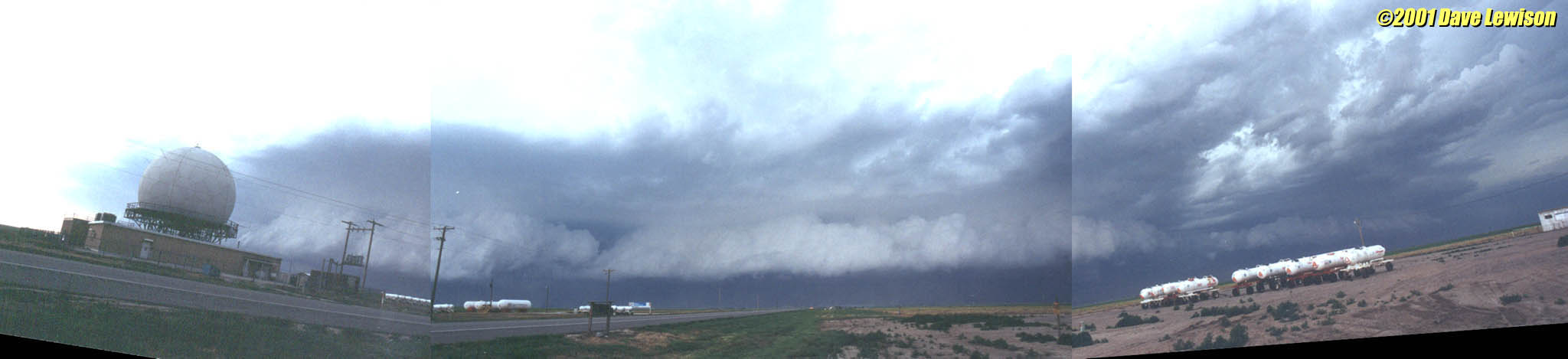 |
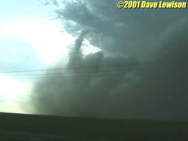
A panoramic shot of the gust front as it approached. |
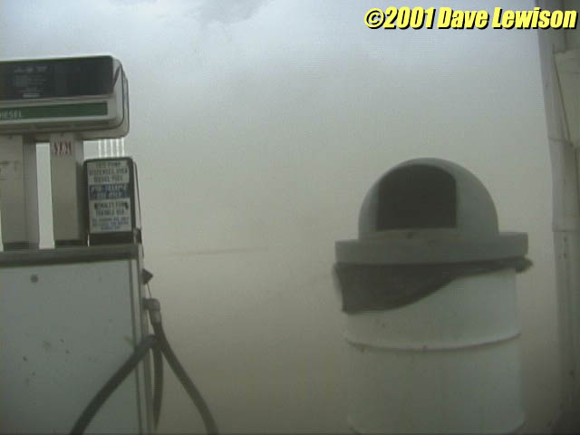 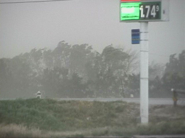 |
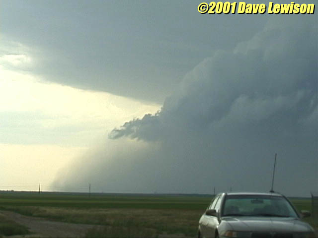
We retreated back to the truck stop and hung out underneath
the gas pump overhang. (Last we saw, this line had some pretty intense cells, so we were
expecting hail). However, this line only appeared to have wind with very little
precipitation. We were rocked by intense winds that kicked up the dust to the point where
you couldn't see more than 15 feet. I got out and measured a couple of gusts at 60 mph,
but I'm sure they were higher at times. It looked like a hurricane at times! It took about 15 minutes for it to start raining, but even then it wasn't too intense. This was mainly a dry wind event. Pretty interesting. |
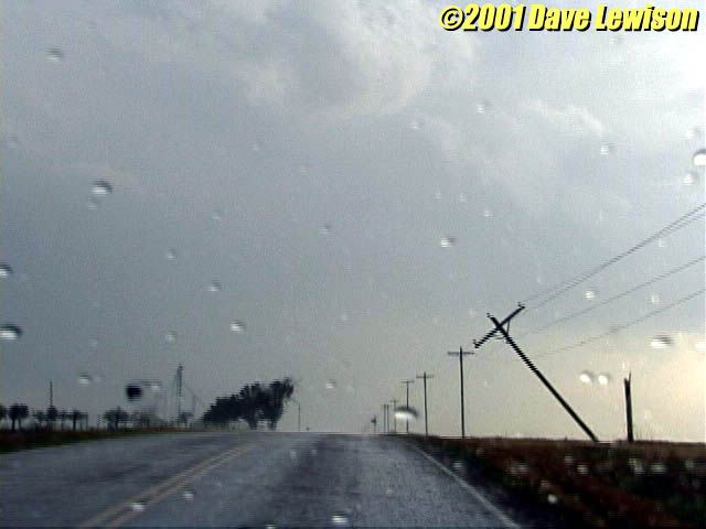 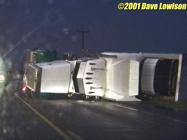 |
We decided to put in at Woodward, OK for the night. Along the way, we saw some damage that had been caused by the squall line. There were a number of snapped power poles, and even an overturned semi on route 422. Near Woodward, there were many downed tree branches, and some evidence of hail damage (shredded foliage). Most of Woodward was without power for quite some time. Unfortunately, this made getting data the next day nearly impossible! |
| Not a bad day. That was the most impressive gust front I had ever seen, and putting that radome in the foreground made for an impressive photo...one that's hanging on my wall right now. I also had a lot of fun getting out and measuring the wind speed. What good is severe weather if you can't really experience it? :-) | |