Chasers: Dave Lewison & Cloud 9 Tours
|
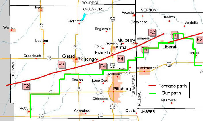
May 4: Violent
Tornado Near Girard KS Chasers: Dave Lewison & Cloud 9 Tours |
VIDEO: Click for a small 30-sec (3MB) video clip of the Girard tornado.
 |
|
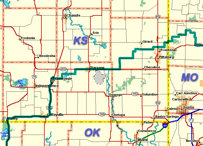
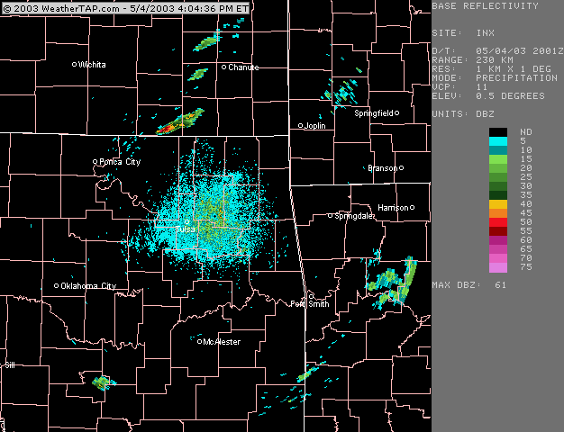
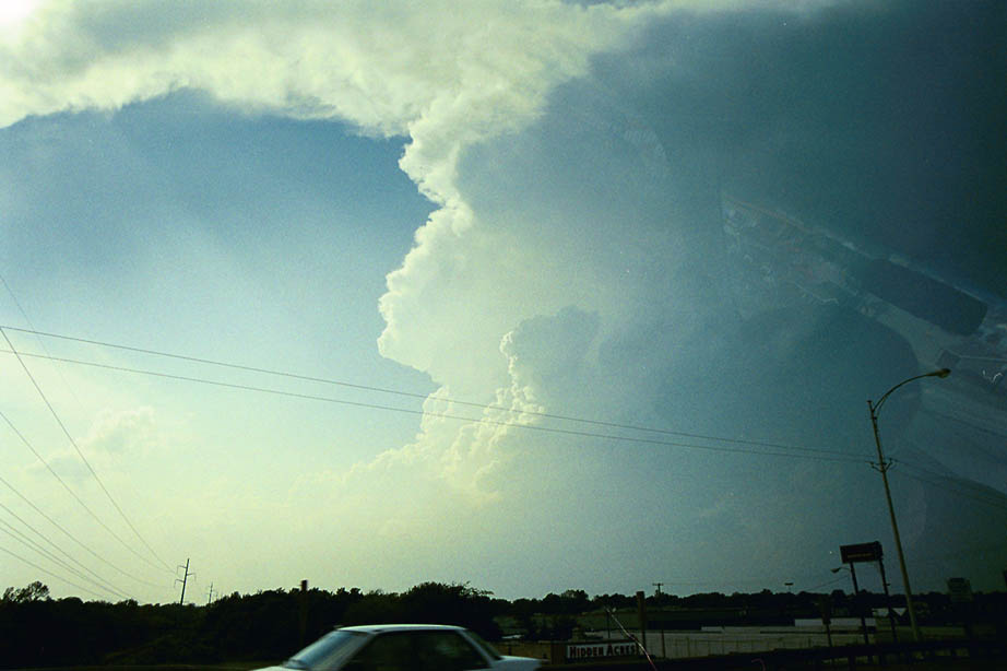
Click any image to enlarge to full size... A big day with an SPC HIGH Risk over much of Arkansas and Missouri. Initial target: Tulsa OK to Joplin, MO. Started the day in Norman. After breakfast, left around 11 am on I44 east to Tulsa. Got data on the road and noticed clearing was up further north towards the KS state line. Decided to head up on 75 to the KS border and then east over to Coffeyville. Watched a small cell get organized for a little while. Pulled up more data which revealed that this was pretty much the only cell in town. Went north and east through Parsons KS as the cell developed. In these reflectivity images, our storm formed just north of the KS border and began right-turning south of Chanute.
|
 Initiation began just north of Coffeyville KS. |
 A view of the young updraft looking west as we headed north on 169. |
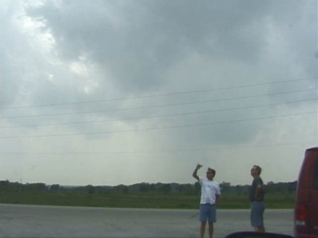
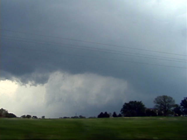
 A first attempt at a wall cloud. |
 The second attempt. After only 40-60 minutes, this storm had a violently rotating wall cloud with shark's teeth around the periphery. |
 A strong RFD clear notch as we head north, just east of Parsons. |
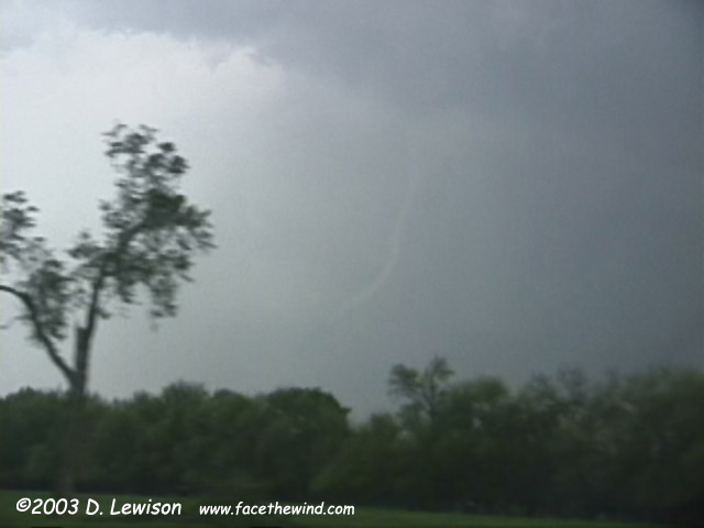
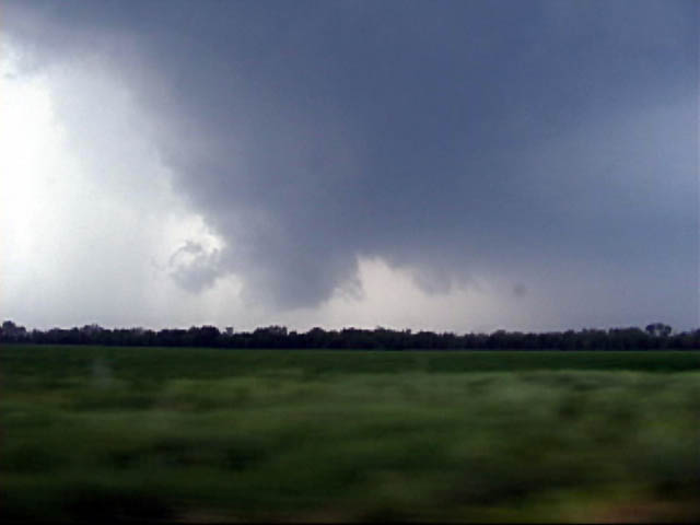
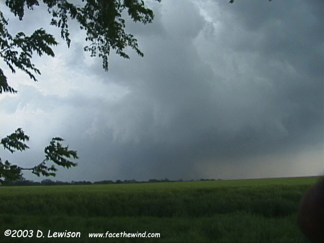
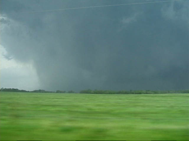 Heading north through McCune, we get a first close look under the base. Is it a rain shaft? A Wedge? |
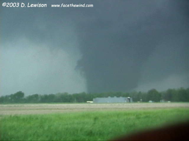
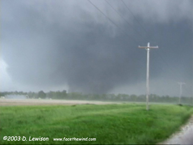
 The answer becomes clear heading north on 126 just SW of Girard. We caught sight of the massive black wegde on the ground. Here, a horizontal vortex is visible to the upper left of the main one. |
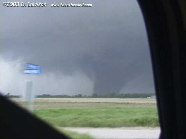
 Violent motion was visible on the left side of the vortex. |
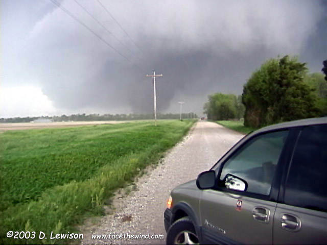
We watched as the tornado rapidly moved northeast. The storm was moving at nearly 50mph at this point. |
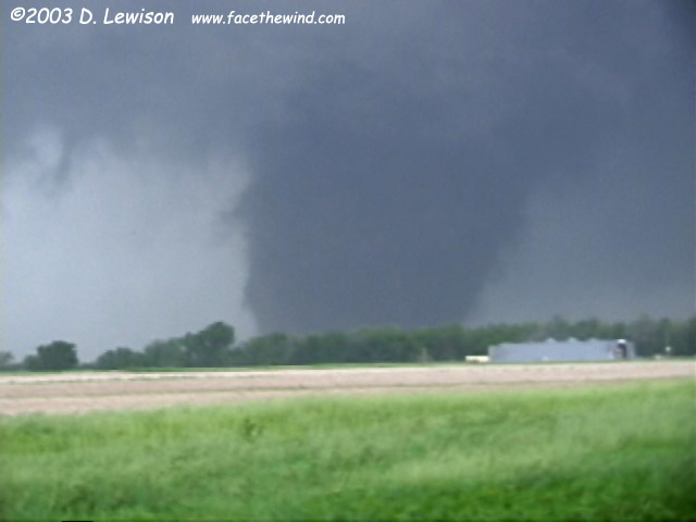
The RFD winds hit our location about now, kicking up clouds of dust from the adjacent field. Very rapid collar cloud rotation. |
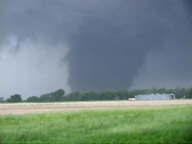
Jim's van and the tornado in the background. We first saw the tornado as it was to the left of the small metal building. It got to this point in only about 45 seconds! We needed to blast east to keep up! |
|
|
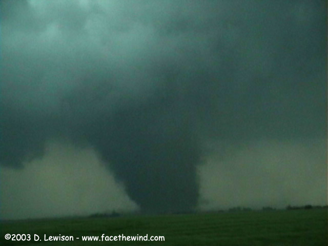
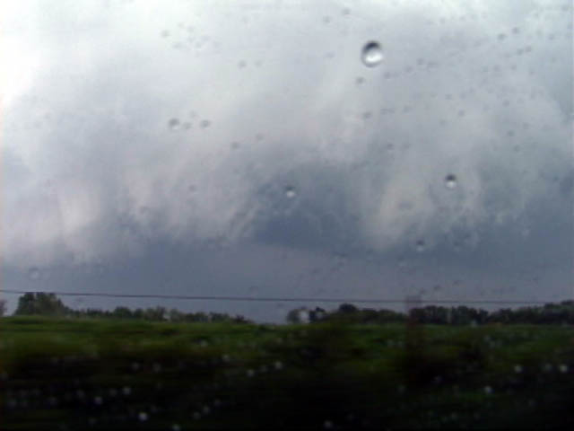
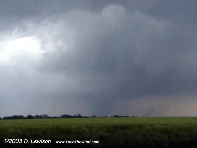 The base, looking NE. The tornado would occasionally "un-wrap" from its precip shield. |
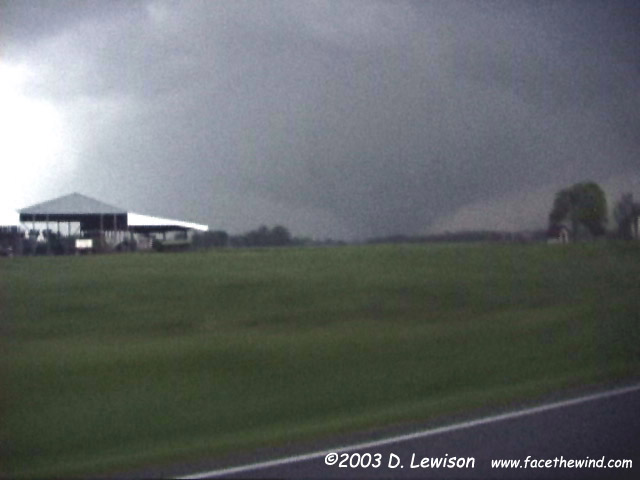
 Precip cleared out for a moment, but not for long. This, combined with a few navigation "issues" caused us to lose sight of the tornado just before the MO border. Charles Edwards was 4 miles further up the road and got a much better view. |
Near Liberal MO, we again caught sight of the ghostly white tornado as it gracefully roped out. Another tornado had just begun 5 miles east of Liberal, but it was moving so fast, we would never catch up. |
|
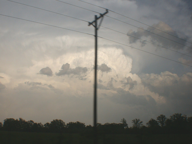
We were treated to a spectacular view of the storm's updraft. View here is to the South. |

Email me at: lewisd2@alum.rpi.edu