Chasers: Dave Lewison & Cloud 9 Tours
|
May 15: 5
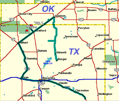
Tornadoes in N. TX Panhandle Chasers: Dave Lewison & Cloud 9 Tours |
VIDEO: Click for a small 30-sec (3MB) video clip of the Stratford tornado.
 |
CLICK HERE for an extended version (2m30s, 10MB)
 |
Click any image to enlarge to full size... ANOTHER SPC High Risk that verifies. Initial target: Near Amarillo TX |
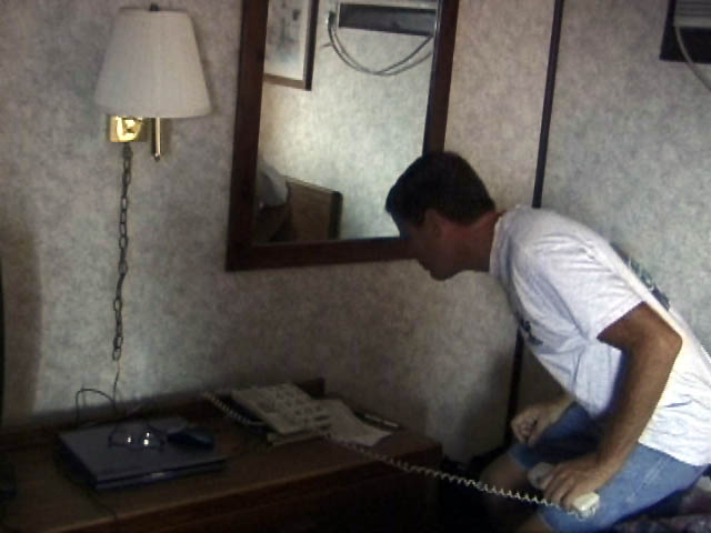 We awoke to partly sunny skies in Childress, where Jim's room came with a phone with HUGE buttons. C'mon, Jim, you're not THAT old! Here he is pretending that he can't see the gigantic numbers. :-) |
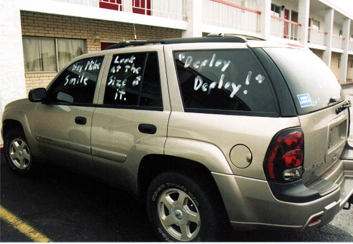 Charles, John and I then "decorated" Mike's truck with what we knew was going to happen later that day. Can you say foreshadowing??? We ate some lunch and headed up 287 towards AMA. |
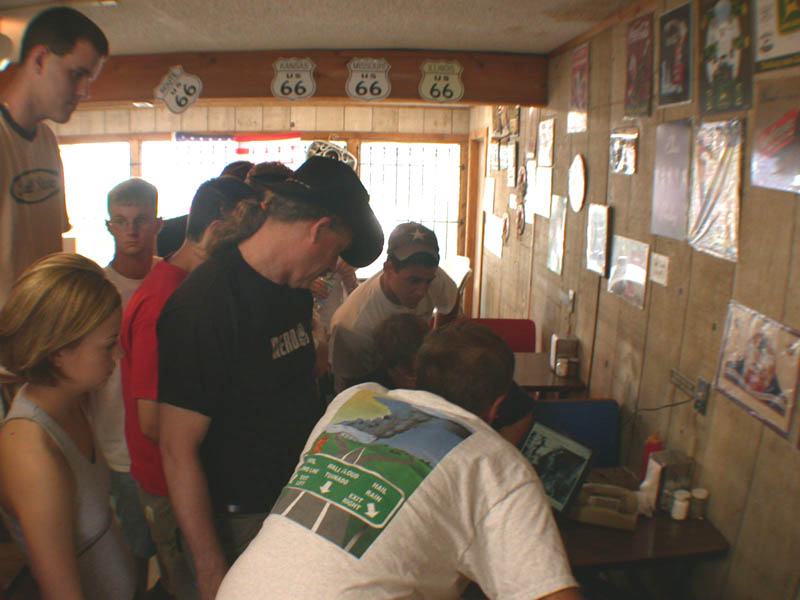 Just west of AMA, we stopped in Vega for some data, where we saw other chasers gathered in a small truck stop. These folks are the Ball State Chase Team. Outside, we noticed a distant anvil to our NW coming out of NM. Decided that this was the target storm, as it would get into much better air in TX. |
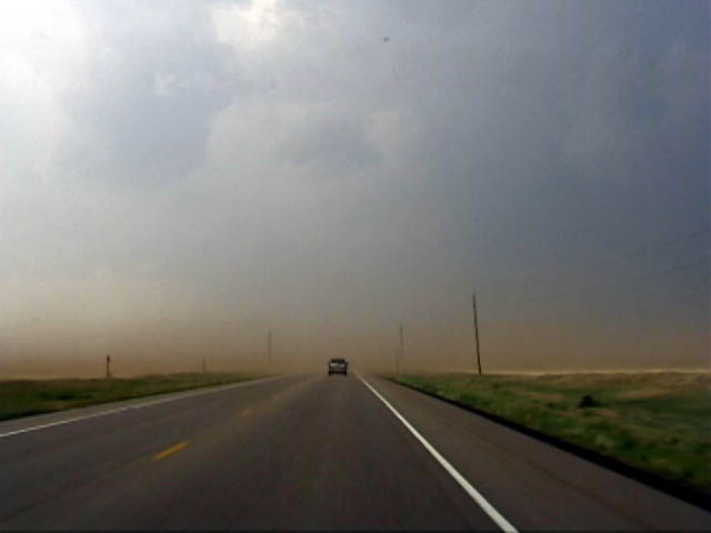 Southeast of Dalhart, the storm really started sucking in intense inflow and red dust. |
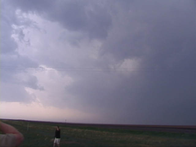 Now NE of Dalhart on 54, we observed the base to our NW. Not too organized...yet. A quick radar image revealed that this storm was starting to organize nicely. |
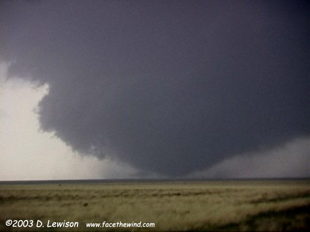
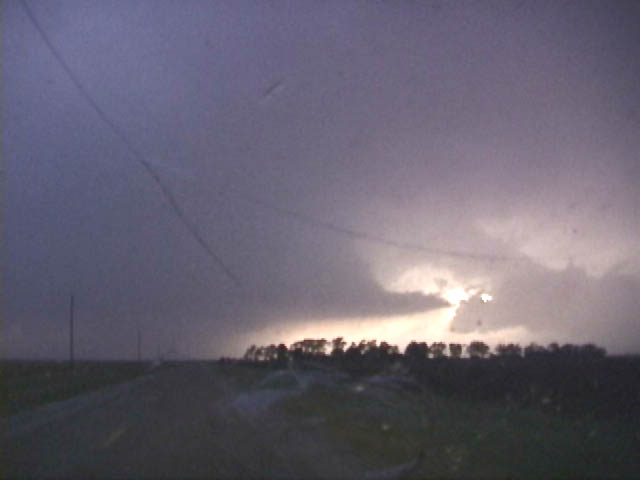
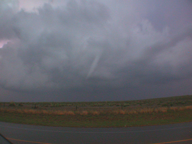
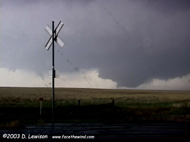 We followed it up 54 and set up on 287 just NW of Stratford. Looking WNW, the storm had a very low wall cloud with visible clear slot wrapping in. A second, possibly ANTICYCLONIC tornado is visible to the left of the RR crossing sign. |
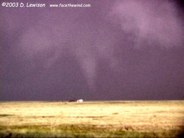
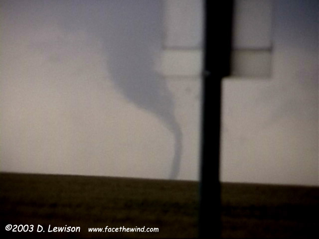 Closeup of the possible anticyclonic tornado. I've never seen anything like this before! |
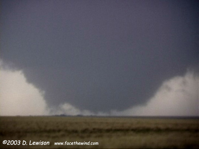
 The main wall cloud is dragging the ground now, condensation fingers spinning around like a merry-go-round. |
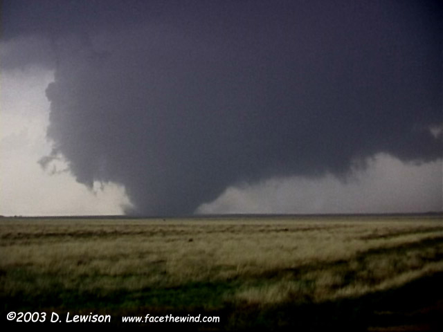
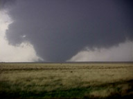
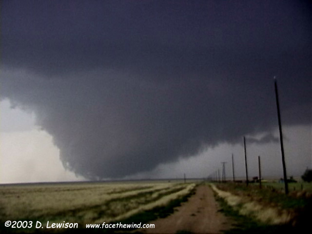
 A multi-vortex wedge tornado setting up here. |
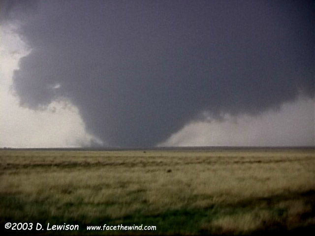
Big bowl tornado. |
I think we can call this a "wedge" now! |
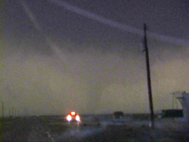
Still on the ground, now looking NW. We went north to attempt a deployment of the "Dillo-Cam". However, the circulation lifted and became heavily precip-wrapped. We were then slammed by baseball hail, shattering the front windshield (still driveable). |
A little further east, a second tornado develops (looking NE). This image is contrast-enhanced. After this, we chased the cell for a while NE into the OK panhandle, but gave up because it was an obvious HP bomb and we wouldn't likely see anything more out of it. |
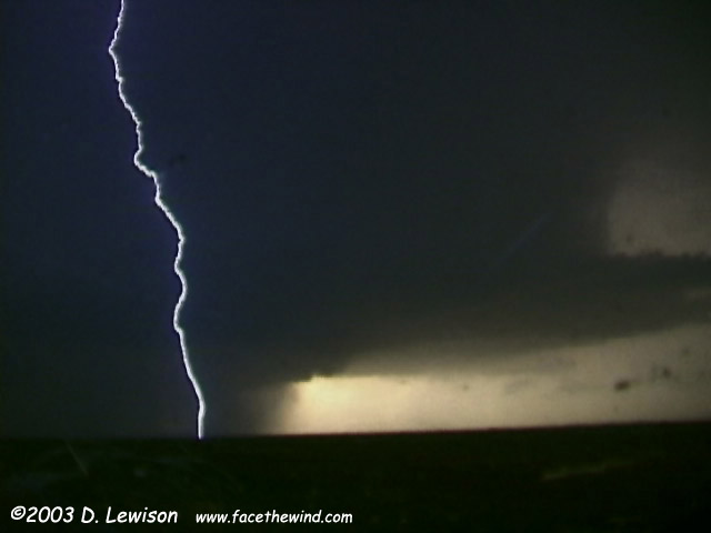
Further south near Gruver, we intercepted this tornado-warned cell, with amazing inflow tails from the NE. |
It was also putting out a spectacular lightning show underneath the updraft vault. |
Through the broken windshield, you can see a barely-visible stovepipe tornado wrapped in rain. This image is contrast-enhanced. |
Okay, we thought we were done for the day. North of Stinnet, we saw a nice bell updraft illuminated by lightning. Approaching from the north, we started seeing some hail, so we decided to let it pass (didn't want to TOTALLY smash the windshield!) When we proceeded, we saw the tail end of the storm, complete with a distinct cone funnel. A few moments later, there was a bright power flash 1/2 mile down the road (rte 136), confirming that this was a tornado! |
View of the tornado to the east. This was a long-time exposure because it was 9:00 at night. |
Tornado ropes out. We passed a very narrow damage path closer to Stinnet. |

Email me at: lewisd2@alum.rpi.edu